Final Report For 2006 Sea Scallop RSA Program
|
|
|
- Leslie Gilbert
- 5 years ago
- Views:
Transcription
1 Sea Turtle - Scallop Fishery Interaction Study Observing Behavior of Loggerhead Sea Turtles, Carretta carreta, on Foraging Grounds off the Mid-Atlantic United States Using a Remotely Operated Vehicle (ROV) Final Report For 2006 Sea Scallop RSA Program January 2009 By Ronald Smolowitz and Matthew Weeks Coonamessett Farm, Inc 277 Hatchville Road East Falmouth, Massachusetts, USA FAX cfarm@capecod.net 1
2 Executive Summary This project focused on developing the methodologies of using a Remotely Operated Vehicle (ROV) as a research tool for observing behavior of loggerhead sea turtles, Carretta carreta, on foraging grounds off the Mid-Atlantic coastline. The project spent 16 days at sea during three trips; a preliminary testing trip and two research trips. The research trips focused on scallop grounds with water depths of meters, during the months of September (2007) and June (2008), when and where turtles are known to be present. Work included placing video cameras on scallop dredges, using an ROV to search for turtles and to follow turtles once located, and using an ROV to observe behind an actively fishing scallop vessel both in the water column and in the dredge track. During the two research trips we sighted 71 loggerhead sea turtles and 2 leatherback sea turtles. All the turtles were first observed on the surface or within 5 meters of the surface. During the June 2008 trip we were able to follow fifteen loggerhead turtles with the ROV for periods of time ranging from 2 minutes to over 8 hours. We observed a number of turtles feeding on jelly fish, we observed one turtle avoid a shark, and observed one turtle swim from the surface to the sea floor (depth of 60 meters). We collected extensive data on the time interval between breaths on 6 turtles. We also observed sharks and tuna feeding behind the scallop vessel as it discarded. We collected over 20 hours of sea floor video observing the behavior of benthic species including skate, squid, flounder, crab, sand dollars, and sand lance. We documented the association of larger juvenile loggerheads (>50 cm) with Sargassum weed mats. Key observations regarding loggerheads related to dredge interaction include a) they spend considerable time just under the surface, b) they are feeding extensively on jelly fish within the top 10 meters of the surface, c) they do make short excursions to the seafloor through a significant temperature gradient, and d) they turn their carapace towards a potential threat. 2
3 1. INTRODUCTION 1.1 Project Description This original project plan was to 1) identify the mechanisms that cause scallop dredges to take sea turtles during all phases of fishing operations; 2) identify and test methods and technologies for locating sea turtles on the fishing grounds; and 3) test of a new dredge frame design to reduce or eliminate the threat of benthic interactions with sea turtles that may result in capture or injury. Initially we planned to place self-contained video cameras and recorders on commercially fished scallop dredges in the Mid-Atlantic area during the known periods of turtle interactions. Two dredges were to be towed simultaneously, one as a control and one with a new frame design. The fishing characteristics and catch rates of various species encountered were to be compared between the two dredges. In addition, side scan sonar was to be tested to determine its feasibility as a way to locate turtles in the water column. The project made a determination before field work got underway based on other ongoing research, that we were approaching the problem from the wrong perspective. The main task is to observe sea turtle- scallop dredge interactions to see how, where, and why they occur. We were approaching the problem from the perspective of the sea scallop dredge by mounting cameras on dredges and trying to observe a very rare event; a turtle-dredge interaction. We decided to approach from a different perspective; that of understanding the sea turtle behavior. We chose an ROV to be the vehicle for our cameras but ran into operational difficulties in trying to track the sea turtles on our first ROV trip in September We did collect a lot of information on turtle spatial distribution but not on their behavior and location within the water column. After our September 2007 trip we evaluated the difficulties we encountered and came up with some solutions. The June 2008 trip was very successful in observing turtles in the water column. Presently it is not understood what interaction, if any, occurs when turtles encounter chain-equipped dredges or whether the noise of the chains is creating an avoidance behavior. Vessels fishing on dense beds of scallops may discard scallop viscera remains concentrated in a relatively small area, which may attract turtles. In short, there are many unanswered questions regarding sea turtle behavior and interactions with scallop dredges equipped with chain mats. It was the intent of this project to continue to investigate the behavior of sea turtles around scallop dredges and in areas where scalloping has recently occurred. This investigation used underwater cameras and a Remotely Operated Vehicle (ROV) to try to visually identify sea turtle behaviors in situ and also around scallop gear. 1.2 Background In response to increasing numbers of sea turtle interactions observed by the sea scallop industry and subsequently corroborated by NMFS observers, a series of 15 experimental cruises were carried out during the summer and early fall of 2003 on the continental shelf waters of the mid-atlantic Bight (Dupaul et al, 2006). These cruises demonstrated that a simple modification to the standard sea scallop dredge was effective in eliminating the incidence of sea turtle bycatch without substantial associated reductions in the capture of the target species. 3
4 The modification, a chain mat that physically excludes turtles, did not catch a turtles in over 2400 hauls, while the standard dredge caught seven loggerhead sea turtles. An issue was raised after the study about how the turtles interact with the scallop dredge. After the prior study, several proposed the theory that turtles are attracted scallop viscera and lay close to the bottom, while others speculated that the turtles are captured while the dredge is being retrieved. In a meeting between Cfarm, VIMS, and NMFS, there was a stated importance of viewing the scallop gear using video with the hope of seeing a turtle(s) interacting with the scallop dredge. It was discussed that with video, NMFS will be better equipped to assess the effectiveness of this gear modification in not only reducing the bycatch of turtles, but also in assessing the type of interactions that may be occurring. As an example, we do not know if the noise of the chains is causing the turtles to flee from the path of the dredge, if the turtles are getting run-over by the gear, or if the interactions are occurring predominantly during the retrieval of the gear. In 2004, CFarm staff conducted three days of video operations on the F/V Kathy Ann monitoring 16 paired scallop tows with tow times ranging from minutes in duration (Smolowitz et al, 2005). We were fishing approximately 30 miles offshore on a bed of scallops, where turtles had recently been reported. We averaged catch rates of 5 bushels per dredge per tow. Two dredges were being fished but we only monitored the port dredge. We kept the tow path short by using turn around tows and baited the tow path with previously frozen scallop viscera as well as the fresh shucked viscera. No turtles were sighted during the entire trip. We took over seven hours of dredge-mounted video. Additionally we monitored the bycatch in the port dredge over the three days to see if there was an increase in bottom feeders such as crabs. The bycatch of benthos during these tows typically consisted of one half bushel of sulphur sponge, Cliona celata, and 5-10 bushels of sand dollars. There were only a few starfish and crabs in the catch during the whole experimental period. In three full days of covering the bottom with scallop viscera there was no increase in rock crabs or hermit crabs. Bad weather and the end of turtle season terminated the 2004 video operations. A concern that was raised about the turtle chain mats is what happens if a benthic interaction occurs. Our experience leads us to believe that turtles would have to be very close, probably lying on the bottom to get under the bale of a scallop dredge during a tow. Even with these doubts, CFarm staff started work on a dredge frame design that would eliminate two potential points of turtle interaction that could possibly lead to injury. The first was to build the frame in such a way that no turtle could be entrapped in the space between the cutting bar and depressor plate. This was accomplished by moving the cutting bar forward and placing the frame struts closer and at a 45 degree angle. The second change was to eliminate the bale strengthening bars in the frame so that if a turtle managed to get under the bale there would be nothing blocking its escape in front of the cutting bar. The new dredge with these modifications was tested using dead turtles and model turtles videoed by divers in shallow water off Panama City Florida in June, The new frame design seemed to reduce the likelihood of turtles getting trapped under the dredge as anticipated (Milliken et al, 2007; Smolowitz et al, 2008a). In the summer of 2005, under contract to NMFS, CFarm staff continued the dredge video work under general category fishing rules. We had an EFP that exempted us from going in every night to off-load the 400 pound limit which greatly improved our efficiency compared to our efforts in Ten days of dredge-mounted video work, about 70 hours of video observations, were accomplished in areas where we sighted numerous turtles on the surface. However, we were 4
5 not allowed to perform any activity that might increase the likelihood of encountering sea turtles or would not be considered standard commercial fishing. We were not allowed to use scallop viscera to attract turtles nor were we allowed to collect any information from other vessels about turtle locations while at sea. We did compare the new dredge frame design to the standard dredge frame and found that it was as effective at catching scallops (Smolowitz et al, 2006; Smolowitz et al 2008b). However, the observed take rate of sea turtles in the scallop fishery is about one turtle take per 1000 hours of towing. There was a need to continue the video effort which resulted in this project. 2. METHODS The project s original plan was to place self-contained video cameras and recorders on commercially fished scallop dredges in the Mid-Atlantic area during the known periods of turtle interactions. Two dredges were to be towed simultaneously, one as a control and one with a new frame design. The fishing characteristics and catch rates of various species encountered were to be compared between the two dredges. Since the original plan was developed and approved for funding we had the opportunity to test on a number of trips the new dredge frame and were confident of its fishing characteristics (Smolowitz and Weeks, 2008). We had decided that the project needed to focus on discovering where the turtle-dredge interactions were occurring in the water column. The best way to ascertain where these interactions are occurring is to have the flexibility to maneuver the camera in the water column, to video tape moving at higher speeds, and to be able to cross the various special access area boundaries free of regulatory restrictions imposed when using dredge gear. For these reason we had decided to try towing our cameras on dive planes and not use dredges until we have successfully encountered and video taped a turtle. We also decided to test an ROV as a means to monitor turtle behavior. This was a switch from the plan to use side scan sonar to determine its feasibility as a way to locate turtles in the water column. We submitted changes to the project work plan which were approved (Existing End Date: November 2007 Proposed Extension: November 2008). One major change was to shift from a single vessel strategy in which only dredge mounted cameras are used to a two vessel strategy. To keep costs down the first vessel was a volunteer vessel operating under normal fishing conditions. The second vessel was the F/V Kathy Ann utilizing a Benthos Teledyne Stingray ROV system. The two vessel strategy was to follow closely behind the towing vessel and observe the activity occurring in the water column in the vessels track. We also examined tow paths immediately after the dredges passed. The study took place in the continental shelf waters 50 to 100 kilometers offshore of New Jersey and Delaware along the east coast of the US. Water depths ranged from 50 to 100 m. Loggerhead sea turtles migrate up into this area in June, forage for most of the summer and fall, and migrate south, or possibly offshore, during October. Sea surface temperature (SST) ranges around 20 to 23 degrees C during this period and bottom water temperatures increase from about 7 degrees C in June to 12 degrees C in October. The warmer waters of the Gulf Stream lie further offshore to the east. We conducted two ROV trips; one in September 2007 and one in June We conducted the study from the scallop vessel F/V Kathy Ann utilizing a Benthos Teledyne Stingray ROV system. On the September trip the vessel also was rigged to fish a 4.5 m wide commercial New Bedford style scallop dredge. On the June trip no dredge was rigged to allow the vessel more 5
6 freedom from regulatory restrictions controlling access to scallop areas where the interactions were known to occur. 2.1 ROV Operations The Stingray ROV on the September trip was fitted with 2 color video cameras for most of the dives: an 18 to 1 color zoom camera with 1 lux light capability and a fixed focus color camera with 0.1 lux capability. The ROV control box has a switch that allows the pilot to switch between cameras. With an additional monitor connected to the topside electronics, it is also possible to have both cameras display their images simultaneously. Full-range dimmable Deep Sea Power and Light halogen fixtures were mounted along with the multibeam sonar and the color zoom camera on a user-adjustable tilt bar on the front of the vehicle. This tilt function allowed the multibeam sonar to be adjusted for the optimum grazing angle to represent objects and features in the water column as well as on the seafloor. It also enhanced the ROV pilot s ability to collect detailed video of fish, objects and seafloor features. All video was recorded directly to DVDs using a Sony VRD-MC5 recorder set to HQ mode, putting as much as 1 hour of high quality video on each DVD. The multibeam sonar used was a BlueView Technologies ProViewer P450E ( which uses acoustic energy to produce streaming images of objects and features underwater. It weighs about 6 lbs in air and 1.4 lbs in water. The field of view is 45 degrees by 15 degrees with a range of up to 150 meters. The system produces the images with 256 beams of acoustic energy at 450 khz, giving it the ability to resolve objects as small as 2 inches. The depth rating is 1000 feet. Power consumption is 10 watts at 12 to 48 volts with the Ethernet extender bottle on the vehicle drawing an additional 3 watts. The streaming images are transmitted over a twisted shielded pair of conductors in the tether to the topside via an Ethernet extender bottle at up to 10 frames per second. The actual frame rate we experienced was dependent on the range selected and was in the 4 to 8 FPS range. Initially, the frame rate was 3 FPS every other second with regularly scheduled one second drop outs. It turned out that the Teledyne network synchronization software installed on the laptop was attempting to synch the laptop data with the BlueView, causing the data rate to drop and inhibiting data transfer to the laptop. Once this software was disabled, the frame rates came up to 4 to 8 FPS. The maximum length of copper conductors over which the data can be transmitted with the Ethernet extender is 2000 feet. All sonar data was recorded on a laptop hard drive. For example, on the September 2007 trip the 30 files occupied about 8 gigs of space. The ProViewer software, supplied with the sonar data files allows it be replayed with the user having the ability to make adjustments to the range, intensity and other parameters to resolve objects of interest more clearly. It also allows the user to export JPEG and AVI movies of the data for playback with conventional software. The BlueView website describes the operation of the sonar in the following way: Placed in horizontal or vertical positions you can collect forward looking 2-D images of underwater environments or accurate profile views of structures and the bottom. These images provide a realistic view of submerged objects, shipwrecks, fish, divers, and bottom features, even in very shallow water. 6
7 2.2 Operating Procedures The basic procedure for conducting transects was as follows. At approximately 0700 we began a transect holding a straight course based on the best sighting conditions (sea state, wind, glare, etc) at a speed of 4 knots. Three observers were on the lookout for turtles. One observer was posted in the masthead crow s nest at an eye height of 14 m above the sea surface. Another observer was posted on the foredeck at an eye height of 4 m above the sea surface. The third observer, usually the Captain, was in the pilot house with an eye height of 4 m above the sea surface. All observers used binoculars for scanning around the vessel. The masthead observer was also equipped with digital cameras and a GPS recorder. When a turtle was spotted the vessel was directed to approach. Some turtles were spotted submerged 2-5 m deep very close to the vessel and others were spotted several hundred meters away on the surface. We stooped the vessel for the turtles that were close and maneuvered to within 50 m for those spotted at a greater distance. Positions were recorded and a continuous GPS plot maintained. For most of the dives, the ROV was deployed from the rails of the vessel with 2 tether handlers on deck. On the September 2007 trip the tether was coiled on deck; on the June 2008 trip we used a manually operated electric winch to handle the tether. The ROV was launched and the operator maneuvered towards the turtle, many times under the direction of the observer from the masthead using VHF radio communications. Owing to the high level of background noise on the vessel, verbal communications between the deck and ROV control station was limited. We discovered that it was best to approach the turtle from the turtle s front and not from behind to avoid startling the animal and causing it to dive. We also found it was best to stop the ROV once the turtle was in view on the ROV video camera, usually 3-5 meters away. We would then track the turtle maintaining a distance of 3 to 5 meters if possible. If the turtle approached the ROV we would remain still and let the turtle investigate the vehicle. When we lost video contact with the turtle we would use the BlueView sonar to search as well as visual searches from the vessel. If no contact was made we would then proceed to do a bottom search Bottom Search Mode On a number of occasions we would send the ROV vehicle to the bottom in stages. The ROV was equipped with an Onset Tidbit temperature recorder so we could record temperature on the way down and at the sea floor. We would stop the vehicle and hold depth at every ten meters to define the thermocline. Once at the seafloor we would go into a search pattern looking for turtles while also observing benthic fauna Dredge Observations On the September 2007 trip we towed the scallop dredge and used the ROV to search the dredge path for activity as well as following a second vessel while it towed a dredge. In the June 2008 trip we only utilized the two vessel strategy where the F/V Kathy Ann followed closely behind the towing vessel and observed the activity occurring in the water column in the vessels track. We also examined tow paths immediately after the dredges passed. 7
8 3.0 RESULTS Approval to conduct the project was received on August 11, LOA requests were written and three compensation collection trips were conducted (see Appendix A). With the increased revenue collected, due to higher scallop prices, a revised work plan was developed and approved to take into account the opportunity to use the ROV as well as latest changes in scallop access areas and information on turtle movements. During the compensation trips of the F/V Westport and the F/V Celtic comparison tows were made between an experimental turtle dredge design and a standard dredge. The data was analyzed (Smolowitz and Weeks, 2008) and used in deciding what dredge would be utilized during the video work in Due to the late start of the project a time extension was requested, and approved, in order to conduct the video work during the turtle season in On September 20-21, 2007 we did a shake down cruise aboard the F/V Challenge out of New Bedford. We tested our suite of dredge mounted cameras and methodologies for handling and operating the Stingray ROV in a location south of Martha s Vineyard. The equipment was then prepared for transport to Barnegat Light, New Jersey. On Sunday, September 23 the F/V Kathy Ann departed Barnegat Light on trip at 0800 heading Southeast on a search transect directly in line with Carteret Canyon. A charter fishing vessel returning from that canyon had spotted sea turtles in depths somewhere between 50 and 20 fathoms. The trip Summary can be found in Appendix B. 3.1 Report on use of Stingray ROV; September 2007 For 9 days, the Teledyne-Benthos Stingray Remotely Operated Vehicle was used aboard two fishing vessels, the F/V Challenge for a short trip south of the Vineyard and the vessel F/V Kathy Ann for a week out of Barnegat Light, New Jersey. During that time, 23 ROV dives were made producing a total of 17 hours of high quality color video and 30 multibeam sonar files. For most of the dives, the ROV was deployed from the rails of the boats with 2 tether handlers on deck. Owing to the high level of background noise on the vessel, verbal communications between the deck and ROV control station was limited. While attempting to get sonar and video images of the many sea turtles that were spotted on the trip out of Barnegat Light, we were repeatedly confounded in our efforts by high background noise, the drift of the vessel, the poor operation of the magnetic compass on the ROV and sea states that bounced the vehicle when it was near the surface. This motion near the surface made the use of the sonar less effective. Small targets were frequently spotted briefly but were not visible fractions of a second later as the vehicle swung laterally or vertically. It was also apparent that we needed voice activated communications between spotters, tether handlers and the ROV control area to get and keep the vehicle headed towards turtles that were within a hundred feet of the vessel on several occasions. It was also apparent that the magnetic compass on the vehicle needed to be replaced. It would not represent headings from west through north to east, instead swinging rapidly through that entire range, indicating course changes of up to 180 degrees in ¼ of a second even though the vehicle was on a nearly steady heading. Additionally, the auto heading function was not optimized for use with the magnetic compass: it would not keep the vehicle on course at any heading, even when vehicle headings were in the southerly half of the compass rose. The gyro compass had too 8
9 much drift make it a viable alternative since resetting it had to be done on the deck of the boats as they were rolling, pitching and yawing. Resetting the gyro while the vehicle was on the bottom gave good results and allowed the auto heading to be used with a higher degree of reliability. The auto depth function worked well for maintaining a fixed height above the bottom for doing sonar searches. For doing transects at or near the seabed, 2 sash weights were attached to the tether 50 to 75 feet up from the vehicle with lashings, tape and tie-wraps. This worked well when the vessel was drifting at speeds of less than 1 knot, allowing the pilot time to visually investigate targets seen on sonar. The sonar was excellent at resolving small objects at distances of up to 100 feet near the bottom, with shells of clams and scallops standing on edge being particularly good acoustic reflectors. Larger features were easily resolved at distances up to 150 feet, with sand waves and rocks being very well represented acoustically. The sash weights and the tether could be seen well with the BlueView as they dragged across the bottom, giving a reference point during searches. In dives near the surface, small fish, mats of Sargassum weed, sharks and floating objects at the surface were easily resolved with the BlueView at distances of up to 125 feet. The cameras gave images of fish in the water column at distances of up to 30 to 35 feet. The vehicle was fitted with a 3 point polypro bridle for one transect where it was towed near the surface at speeds up to 5 knots while looking for animals in the water column. The tether was taped to a length of polypro and the vehicle was let out to approximately 200 feet behind the boat. The vertical thruster was used to drive the vehicle deeper; the lateral thruster was run to push the vehicle out to the side, away from the prop wash of the boat. 3.2 September 2007 Operations After the two days of testing on the F/V Challenge we packed up the equipment and moved the operation to Barnegat Light, New Jersey. The F/V Kathy Ann departed on Sunday, September 23, 2007 and a detailed trip narrative can be found in Appendix B. During the trip, 17 hours of video were taken along with a similar amount of sonar data (Table 1). There were a total of 23 turtle sightings made visually; some possibly could have been duplicates (Table 2). None of the turtles were recorded on video using the ROV cameras. Some video was acquired from the masthead. Approximately 10 hours of the ROV video was taken on or near the seafloor looking for turtles. While no turtles were observed we did get good observations on the behavior of scallops, fourspot flounder, skates, sand lance, squid, and many other species. We have lots of data on the micro-distribution of sand dollars which may turn out to be a good indicator of bottom disturbance. We gathered information on the location of jelly fish in the water column as well as smaller planktonic organisms. On Station 9 we used the ROV to observe the standard scallop dredge. We had been anchored using the dredge and started to shorten scope to lift the dredge off the bottom. This provided a turtle s eye view of an oncoming dredge in the water column (Figure 1). The bale bars can be seen as definitely having the potential to herd a turtle down into the dredge bag, or even snag the turtle. 9
10 On Station 20 we came across an area with large mats of Sargassum weed (Figure 2). A number of turtles (>50 cm) were sighted over the next few hours as we explored the Sargassum weed mats with the ROV (Figure 3). There were definitely four loggerheads and possibly as many as eight associated with the Sargassum. It was not possible to keep track of each turtle over time. The ROV observed a large community of tropical species of fish below and alongside the Sargassum (Figure 4). There were small fish right under the weed and larger fish below them such as jacks, file fish, and trigger fish. Predatory fish, such as barracuda and dolphinfish were even further out from the mats (Figure 5). The Sargassum made it very difficult to try to maneuver the ROV towards any of the turtle sightings. On Station 30 the F/V Kathy Ann followed close behind the F/V Nelson Blount while she towed two scallop dredges. The ROV was towed astern of the F/V Kathy Ann, usually at a depth of m. In this position we were able to locate the discard stream from the scalloping vessel by observing shucked scallop shells and viscera in the water column. Tuna and sharks were sighted on the sonar probably feeding on the discard. We were able to close in using the sonar until a visual image was obtained (Figures 6 thru 9). Turtles were observed in the vicinity of the towing operation. We observed a scallop dredge tow path with the ROV right after the dredge passed but found no fish, crabs, or turtles feeding. Bad weather terminated this trip. 3.3 June 2008 Operations Over the winter we improved our strategy for acquiring and tracking sea turtles. On June 16, 2008 we went to sea and applied our ideas with amazing success. We gathered many hours of video following sea turtle and observed what depths they occupied, how often they went to the surface, what they were feeding on and how, behaviors to avoid sharks and vessels, and much more. We even followed one turtle to the bottom in 60 m where water temperatures were 7.6 C. We did have some problems. Just before sailing our long tether failed so we had to conduct the project using a short, 100 m tether. We also found that turtles can dive much faster than the ROV. There is also a permitting problem. We can not move into and out of the various scallop access areas and utilize a dredge without an EFP. We went on our trip with plans to mount cameras and tow the dredges but the opportunity did not arise in an area where we were allowed to fish. We left Barnegat Light at 2000 on June 16, 2008 on The F/V Kathy Ann. We steamed all night to the Northwest corner of the Elephant Trunk Area (ETA). The trip summary is Appendix C. The short tether made it extremely difficult to stay with a turtle once we acquired it on video. On the first day we lost contact with three turtles we acquired on video before any data could be taken. When tracking a turtle the key information recorded was time at depth, time between breaths, and activity such as feeding. A summary of turtle tracking data can be found in Table 3. 10
11 3.3.1 Turtle densities While this project was not a survey effort, we did obtain some interesting data on loggerhead abundance. We operated in areas where we thought we had the highest opportunity to locate turtles and were also known scallop grounds. We searched for turtles by steaming in a line which we called a Transect. On average we traveled at a speed of 4.0 knots. When we spotted a turtle we attempted to launch the ROV and follow the turtle so there were many interruptions during the course of a day. However, at the end of the day we transited a known distance and observed a number of turtles. During the June 2008 trip we divided the cruise into six transects. Table 4 presents the length of each transect and the number of turtles sighted. If we make the very conservative assumption that we can sight every turtle within 500 meters of each side of the vessel, each km of track would represent one square km of observed area. This yields an average turtle density of loggerheads per square km in the areas we were operating in during June Turtle Behavior to ROV We observed a range of behaviors in the loggerhead in association with the ROV. The large male #15 initially observed the ROV, then slowly approached, and then continually butted the camera lens. After a few minutes it lost interest and continued to swim northeast never paying attention to the ROV again for the remaining 40 minutes we followed. We lost contact with turtle #34, which was tracked for over 7 hours, on a number of occasions. The turtle actually re-acquired the ROV on several occasions and even waited alongside the vessel until the ROV was re-launched (see trip narrative Appendix C for more details). Other turtles, when startled by the approaching ROV, would do a straight down dive Turtle feeding Behavior Three turtles that we tracked were observed to feed on jelly fish; lion s mane, comb jellies, and salps (Figure 10). Commonly the turtle would dive to depths of 3-11 meters and swim casually along. The turtles did not go out of their way to grab some passing jelly; the jelly almost had to be passing within a meter. One smaller loggerhead could not finish the jelly in one bite but did not attempt to retrieve any uneaten portions of the prey. Turtle #34, tracked from 0853 to 1627 (Figure 11), was observed to feed at 1055, 1458, 1504, 1611, and Turtle #39, tracked from 1016 to 1840 (Figure 12), was observed to feed at 1256, 1445, and Turtle #41, tracked from 1700 to 1840, was observed to feed at 1733, 1739, 1746, 1758, 1802, 1813, 1825, 1829, 1831, and Turtle Diving Behavior Table 3 contains the data from all turtles that were tracked and two or more breaths recorded. We recorded 372 breath intervals for 6 turtles which averaged just less than two minutes between breaths. We lost momentary contact with two of the turtles on numerous occasions, #34 and #39, so the data was segmented and only analyzed during the periods we observed. Turtle 15, a larger male (based on observed tail length), was traveling northeast just under the surface and did 11
12 not take breaths as frequently as the other five turtles. Turtle #7 was heading north and make a couple of excursions to 5-7 meters hence the longer breath interval compared to the average. Turtle #34 was the turtle we followed down to the sea floor (Figure 13). During the 8 minutes we were able to stay with the turtle on the bottom it was slightly negatively buoyant (the turtle actually glided the last 30 meters to the bottom). It seems to have been searching and possibly ate a small jelly (sea gooseberry) while on the bottom. This turtle had left twenty-two degree C surface water and proceeded down into water temperature of 7.6 C, in less than three minutes, with no evidence of shock Turtle Behavior towards Shark A common behavior we observed on many occasions is the turtle turning its carapace towards a perceived threat. We have documented turtles performing this behavior when a shark approached (Figure 14), when the ROV approached, and when the vessel approached Summaries of Recorded Behavior: Turtles 4 thru 34 Turtle-4 General Behavior: Passively observant towards ROV, behavior affected by presence of ROV throughout recording Initial Behavior: Turtle presents carapace, slowly dives to 3 meters, holds position and watches ROV from side at a distance. Continuing Behavior: Turtle swims under surface at <1 meter. Final Behavior: Turtle lost while doing slow dive. Turtle-6 General Behavior: Passively observant towards ROV, behavior affected by presence of ROV throughout recording Initial behavior: Dove slowly to 5 meters while watching ROV from side. Then slowly ascends to 2-3 meters under tether, turns towards ROV and slowly approaches ROV head on without coming into close proximity. Continuing Behavior: Turtle changing directions to obtain visual of ROV, preferring to watch head on. Final Behavior: Turtle lost while doing slow dive 12
13 Turtle-7 General Behavior: Turtle initial cautiously curious towards ROV. After a few minutes investigating ROV, continues apparently with disregard to the ROV s presence. Initial Behavior: Observed with turtle just under surface presenting carapace and watching ROV, approaches ROV while occasionally turning and presenting it s carapace at first, then after several passes, approaches ROV headon.. Comes to within close proximity of ROV. Continuing Behavior: After approximately 5 minutes of initial ROV interaction, turtle pays little attention to ROV and swims at a constant pace using slow power strokes towards the north at 0-5 meters with the ROV following behind at a distance, surfacing to breathe approximately every 2 minutes and feeding occasionally (15:46). Turtle apparently spooked by vessel upon first surfacing for breath and dove to 5 meters. Final Behavior: Turtle still indifferent to ROV presence. ROV lost visual during a 8 meters while the turtle was swimming north. Turtle-9 General Behavior: Spooked when ROV would come into field of view, otherwise indifferent. Initial behavior: ROV approached turtle from below at 3 meters. Turtle was facing ROV and holding position. Turtle swam towards ROV briefly, and then turned. After 1.5 minutes, turtle was momentarily spooked and quickly dove from surface to 3 meters, then calmed down and continued swimming with long power strokes northward at 0-1 meters. Continuing Behavior: Continued swimming with long power strokes northward at 0-1 meters mostly indifferent to ROV. Would occasionally turn to look at ROV only when ROV maneuvered along side turtle and made itself within its field of view. When ROV was directly behind turtle, at any distance, the turtle would continue it northward swim with little attention to the ROV. Two small fish associated with the turtle swam back and forth to and from turtle multiple times during the recording. Final Behavior: Turtle was lost after the ROV spooked it. Turtle was spooked when ROV maneuvered over directly over top of turtle in close proximity. As soon as ROV came within turtle field of view it quickly dove and was never required. It was spooked at approximately 3 meters with the ROV at 2 meters. 13
14 Turtle-10 General Behavior: Mostly indifferent to ROV Initial Behavior: ROV approached turtle from behind and slightly below turtle. Turtle was swimming northward at <1m with long power strokes. It did not change behavior as ROV came within close proximity. Continuing Behavior: After following the turtle from behind for over 2 minutes at about 3 meters on a northward course, the turtle suddenly stops turns, looks at the ROV while floating to the surface. The turtle stays at the surface for 1 minute facing and watching the ROV. After 1 minute it takes a breath then 2 more in quick succession. It then continues on its northward course just under the surface, taking a breath every couple of minutes. Final Behavior: ROV looses visual after apparently being pulled back by the vessel. The turtle was last observed continuing on with its swim to the north, just under the surface and not appearing to take notice of the ROV s actions. Turtle-15 Initial Behavior: Initially passive and inactive, then slightly aggressive toward ROV, seemed to be sluggish at first, not making much effort to swim continuously or vigorously at any time during the encounter. Turtle was facing the ROV at the surface and holding position as it approached and stopped a few feet away. Its carapace was breaking the water surface. Continuing Behavior: This behavior continued for over 3 minutes, even as the ROV approached closer and even came into contact with the turtles head. The turtle briefly bit the ROV as it came up and under it, without otherwise changing its behavior. After 4 minutes the turtle starts to swim forward and occasionally butting its head against the camera and biting the ROV. After 5 minutes of recording the turtle takes the first recorded breath immediately after which it dives quickly (might have been spooked by vessel). The turtle was quickly required floating motionless at 1 meter. As the ROV approached, the turtle began swimming slowly for a few seconds and resurface, took a breath and dove to 1 meter, then repeated once more. After this the turtle swam in a northward direction at 1-3 meters without disruption from the ROV. It used slow strokes and did not make any move quickly nor was any other behavior observed. Final Behavior: Turtle last seen swimming northeast at 2 meters below surface. ROV lost visual due to limited tether length. 14
15 Turtle-25 General Behavior: Fairly brief encounter. Continually aware of ROV and keep it with its field of vision did not seem to be afraid of ROV. Initial Behavior: First briefly observed approaching ROV straight on at 7meters within a few feet of the ROV. ROV goes over and past turtle, briefly loosing visual. Continuing Behavior: A small fish is seen close in front of the ROV. Turtle is quickly required and observed facing the ROV holding position at a distance, depth was 7 meters. Turtle then quickly maneuvers to face the surface at an angle then remains still as a large school of tuna (count >30) swimming quickly in from behind the turtle to the direction it was facing. After tuna pass, turtle is observed remaining motionless as it floats towards the surface and apparently watching the ROV as it approaches. Bubbles can be seen coming from the turtle mouth or nostrils as it surfaces. It reaches the surface without moving its flippers. As soon as it reaches the surface it dives quickly toward and below the ROV. It may have been spooked by the vessel upon surfacing to take a breath. Final behavior: Seen diving quickly and never recovered visually. Turtle-30 Initial Behavior: Visual was quickly acquired as ROV approached turtle from its left side while it was floating motionless at the surface. Its carapace was above the surface and its head was under. It appears to have been watching the ROV as it approached. Continuing Behavior: After the ROV comes to within close proximity of the turtle, it takes a breath and dives slowly to 1 meter while watching the ROV. It then briefly stalls at 1 meter then slowly approaches ROV until its head comes within a foot of the camera. A small fish is observed swimming along side the turtle. Final Behavior: Turtle went under ROV, possibly while in contact with it, and was never required. Turtle-32 General Behavior: Turtle never changes behavior throughout recording or acknowledge the ROV s presence. Although the ROV did briefly come to within a foot of the turtle, it remained directly behind and out of turtle s field of view throughout the recording.. 15
16 Initial behavior: Turtle approach directly from behind as it swam just under the surface towards the north taking power strokes. Continuing Behavior: After following the turtle for 45 seconds, it stops and surfaces for approximately 15 seconds and possibly took a breath. It then continues swimming northward just under the surface for another 1.5 minutes. It remains at the surface for 5 seconds (possibly taking a breath) and returns to swimming northward. While on the surface, the ROV comes within close proximity (almost making physical contact) while still directly behind the turtle, it appears to not react to the ROV. Final Behavior: Turtle last observed swimming northward just under the surface as it was when initially acquired. ROV was pulled away from turtle by vessel. Turtle-34 Observation Highlights: Turtle is observed feeding on jellyfish and diving 60 meters to the bottom. Turtle observed within 200 yards of recreation vessel and 0.5 mile of scalloper. General Behavior: The turtle s behavior was mostly unaffected by the ROV or vessel. However, it is only briefly and occasionally spooked by the ROV s thrusters. A visual turtle is lost (due to tether limitations or ROV operator problems) and reacquired several times without a limited amount of observation time lost. At times it appears as if the turtle returns to look of the ROV. Initial Behavior: Turtle floating motionless on the surface (with it s carapace out of the water) facing and watching the ROV as it approached on the surface. ROV came within inches of the turtle s head, but the turtle gave little or no reaction. After initial approach, ROV back away. Took to breaths and made a slow dive just under the surface for a minute and swam generally in the direction of the ROV before surfacing again. Turtle was on the surface briefly, taking one breath, before diving briefly to 3 meters while looking at the ROV. It appears to be curious but not aggressive towards ROV. The turtle will occasionally dive quickly when it get near the ROV, but stops within 1 meter and returns to swimming towards and observing the ROV. This behavior is repeated until 9 minutes of recording. There are many small jellies and comb jellies in the water, to which the turtle pays no attention. Continuing Behavior: About 9 minutes after initial contact, the turtle starts to swim slowly or holding its position towards the south, just below the surface. The ROV is several feet directly behind the turtle, occasion drifting to its quarter and in its field of view. 13 minutes into recording the turtle surfaces very briefly and quickly dives to 3 meters. This behavior was repeated for 10 minutes before the ROV lost the turtle while on the surface. The turtle was reacquired after 7 minutes of no visual. When reacquired the turtle was swimming on the surface towards the ROV. After taking one breath the 16
17 turtle dives to within a meter of the surface and seems to hold position by using minimal movements while facing in a southerly direction briefly then heading in a northerly direction for the rest of the 4.5 hour observation. This diving behavior continues for almost 2 hours. Approximately 10 times during the 2 hours the turtle dives to 3 meters. On occasion the turtle seems to turn to look briefly at the ROV, but does not otherwise change behavior. A couple of times the ROV losses the turtle, but manages to reacquire it within minutes. The turtle s stroke rhythm seemed to increase toward the end of those 2 hours. Feeding Behavior: The turtle does not appear to alter behavior or be otherwise disturbed by the ROV or vessel during the following feeding observations. At time code 10:40:39 turtle dove to 4 meters, then changed course and fed on a salp. This was the first observation of a turtle feeding. After quickly eating it resumed its course swimming to the northwest at 4 meters. There were no large easily identifiable jellyfish present in the water column. At time code 10:41:26 the turtle was still on the same dive at 4 meters swimming northwest when it suddenly stops and briefly maneuvers slightly apparently to feed again. The ROV was directly behind the animal, so what it was feeding on could not be seen. Some comb jellies can be seen in the water. During time code 10:41:30 10:52:54 the turtle did a series of about 8 short shallow dives (short surface time and dives of less than 1 meter, generally lasting less then 1 minute) while still swimming northwest using consistently rhythmic power strokes. No jellies or feeding was observed during this time. 10:55:55 turtle starts at rapid descent straight down to 10 meters. 10:57:00 turtle has leveled off at ten meters and briefly stopped, possibly to feed. A few small comb jellies can be seen. 10:57:25 turtle is at 11 meters and appears to be stopping and feeding again, after which it continues to swim northwest at 11 meters. The current at this time was from the north. When turtle stops to feed, it puts all four flippers out (putting on the brakes) 10:57:50 turtle stops and feeds again for approximately 10 seconds. 10:58:15 turtle behaves as if it has have spotted something visually, maneuvers to change course slightly right and ascends to 8 feet. 10:58:29 turtle eats its target, which appears to be a comb jelly. 10:58:40 after briefly heading northwest again, the turtle appears to have spotted another prey and dive back to feed at 10:59:05. The turtle then immediately maneuvers to the left to feed on another jelly. 10:59:50 turtle rises back up to 8 meters, feeds again, and resumes swimming northwest at 8 meters. 11:00:32 turtle feeds again on comb jelly (good footage), still at 8 meters and facing northwest. 11:00:59 turtle feeds at 9 meters, still facing northwest. 11:01:11, turtle stops for a 10 seconds again. 11:03:11, after swimming northwest at 10 meters, the turtle stops for about 10 seconds. 11:03:27 turtle passes by larger jellyfish on its right while diving to 11 meters to feed again for a few seconds. 11:04:08 turtle at 8 meters the turtle maneuvers briefly to feed again on something to its right. 11:04:40 still at 8 meters heading northwest the turtle stops to feed again. 11:04:59 at 8 meters turtle briefly and suddenly alters course to the east, but does not appear to have eaten anything nor was any jellies visible around the turtle. 11:05:51 8 meters facing northwest, turtle stops to feed and a larger 17
18 jellyfish is passed by the turtle on its right. 11:06:10 turtle rises to 7 meters and feeds for 20 seconds then resumes swim northwest at 7 meters. 11:06:55 turtle eats jelly directly in front of it. 11:07:36 footage briefly ends until 11:08:31(changing disk). When footage begins again the turtle is at 3 meters and free floating to the surface without making any strokes. It reaches the surface at 11:08:45 Total dive time: 12.7 minutes Total feeding observations: ~19 Surface Resting: Visual of turtle is lost for 2 minutes. shortly after surfacing. It is recovered with the turtle swimming just under the surface below the ROV tether. After this feeding dive, turtle continues heading northwest with a 5 minute dive at 2-4 meters. After this dive it continues the same course at <1 meter surfacing to breath after an average dive time of 2 minutes. During this time it surfaces only long enough to take a breath before continuing on just below the water surface. No jelly in the water now and the turtle is no longer exhibiting any foraging behavior. After ~15 minutes of this swimming and diving behavior, the turtle surfaces for approximately 2 minutes (time code 11:27:25). During this time on the surface, it moves all four flippers slowly downward in a treading water motion with its carapace above the surface. The number of breaths taken is not observable from the angle of the ROV s observation. At time code 11:29:45 the movement of the flippers minimal with all four flippers dangling out from its body. The animal is almost motionless except for slight movement caused by wave action. At 11:31:30 the turtle suddenly does a dive stroke and swims rapidly to 15+ meters and continues diving when visual is lost at 11:45 ( time code 11:32:46). No jellies were seen during this dive and bottom depth was 60 meters. Turtle 34 was reacquired on the surface ~800 meters from the vessel at 12:07. The ROV regained visual at time code 12:21:25, with the turtle swimming slowly to the northwest just below the surface. The After this dive it continues the same course at <1 meter surfacing to breath after an average dive time of 2 minutes. During this time it surfaces only long enough to take a breath before continuing on just below the water surface. No jellies or other possible food source was observed in the water. This general behavior was observed from time code 12:21 until 13:46. At time code 13:45:40 the turtle briefly surfaces and does a short 20 second dive before rising again. Upon surfacing at 13:46:00, the turtle does not immediately dive again and instead floats at the surface with its carapace out and flippers out from its body apparently doing the slow treading water type strokes as observed previously (11:27:25). This behavior continued for a total of 4 minutes and 18 seconds. At time code 13:50:18 the turtle suddenly takes a power stroke and begins its dive 60 meters to the bottom. Foraging dive 60 meters to ocean bottom: The deepest dive observed during this study began at time code 13:50:18 (13:58:18 EST) after the turtle 34 had been stationary at the surface for over 4 minutes. Approximate total time it took the turtle to travel from the surface to physically contact with the ocean floor was approximately 2 minutes and 22 seconds. Depth, time, and stroke count was logged at 5 meter intervals. These data were used to calculate speed and stroke rates. To determine the turtle s time at depth, an estimate of distance between 18
19 turtle and ROV had to be determined as well as spatial relation at a specific moment. For the middle portion of the dive the ROV and turtle appear to generally be on the same horizontal plan (less than 1 meter difference), thus at the same depth. Assuming that the turtle was on a mostly vertical trajectory towards the bottom, no estimates had to be taken during these intervals. At other times, the ROV was above and directly behind the turtle at a distance of 1-3 meters. During these moments the turtle depth was determine by taking the ROV s depth and subtracting the estimate distance between the two. (i.e. if the turtle was 1 meter from the ROV, it was at a depth of 5 meters when the ROV had reached 4 meters.) The distance estimate was calibrated using the know turtle distance observed when the turtle was hard on the bottom with the ROV directly above. Although visibility differs at different sections of the water column and the ROV is not always directly above the turtle, this gives a good idea of the size of the turtle at specific distances from the ROV. The observed size can thus be used to estimate distances from the ROV during the dive. So, when the ROV is at depth 55 meters and the turtle on the bottom is at a known 60 meters, the distance is a known 5 meters. Examples used to visually calibrate these distances are shown in Figure 25. Estimates were developed for the last 15 meters in which the ROV momentarily lost visual of the turtle. The estimates for the rates during the 50 and 55 meter bins were calculated by averaging out the difference between the 45 meter data and the final 60 meter data. Sea water temperature was recorded with an Onset Tidbit temperature data logger attached to the ROV s frame. The surface temperature at the beginning of the dive was C and the bottom was 7.49 C for a change of 14.1 C within 2.37 minutes. The data logger used did not have a pressure logging component, so temperature at depth was determined correlating the ROV s depth/time readout with the temperature logger s temperature/time data. The turtle started the dive at a steep angle (appears to be almost vertical) and swam using rapid strokes. At approximately 19 seconds into the dive (time code 13:50:37) the turtle had reached ~5 meters (speed = 0.3 m/s).the ROV briefly lost for a few seconds at 3 4 meters, so a complete stroke count could not be conducted nor a valid estimate made. At time code 13:50:50 the turtles depth was 10 meters and was using the same rapid stroke speed (0.4 m/s during last 5 meters and 0.3 m/second during entire dive). During the 5 to 10 meters the turtle took ~ 7 complete power strokes in rapid succession. Stroke rate was roughly 0.5 stokes/second or 2 seconds to complete a full stroke cycle (from top to bottom back to top). 15 meters was reached 13:51:09, 19 seconds from 10 meters for 0.3 m/s. A tabular summary of behavior observed during the descent to 60 meters is found in table 5. A graphical illustration of stroke rates, temperatures, and thermocline can be found in Figures 18 and 19. Turtle 34 reached the ocean floor at a depth of 60m at time code 13:52:40. The actual landing on the surface floor was not observed due to ROV loosing visual contact with the turtle. The last 15 meters and 23 seconds of the dive were not recorded. The ROV was 9 meters above the turtle when it was required. At this time the ROV was looking down at the turtle, whose entire dorsal was visible, signifying that it was perpendicular to the ROV and probably already on the ocean floor. The fore flippers were also observed stroking (or perhaps walking ) as the turtle traveled in the opposite direction while the ROV was approaching the bottom. 19
20 Benthic Foraging Behavior at 60 meters: The turtle can be visually seen moving along the bottom on a southwest heading at time code 13:52:52. At this time the ROV is 5 meters from the bottom looking down at the turtle. The ROV manages to follow the turtle along the ocean floor for 8.5 minutes before running out of tether and being pulled away by the vessel. The uniformly flat bottom type consists of shell hash, scattered recently cut scallop shells, and sand. There is also a noticeable amount of marine snow and plankton in the water and as well plenty of ambient sunlight for visibility (although the ROV s lights are on). At 13:52:56, the ROV is 3 meters off of the bottom, at which time the turtle has stopped momentarily with its head reaching out, as if foraging. There are ~6 cut scallop shells within view scattered around 1 meter or more away from the turtle. 13:53:18, the ROV is hovering within a meter of the bottom and following immediately behind the turtle at a distance of 1-2 meters. The turtle is moving along with all four flippers touching the bottom in a consistent asymmetrical gate. 13:53:49 turtle stops for ~20 seconds and the ROV lands on the seafloor ~1 meter directly behind the turtle (depth is still 60 meters). During the 20 seconds, the turtle is observed wiggling slightly from side to side as if moving its head during foraging. Its head not in view, so what it was actually doing or perhaps eating can not be determined. After 20 seconds it continues on to the southwest. A tabular summary of behavior observations is found in Table 6. Final Behavior & Feeding Turtle 34 was spotted again at 14:40 on the surface from the masthead in the same general area, after loosing it on the bottom at 14:01. The ROV required turtle 34 at time code 14:45:53 swimming northwest at 2 meters. It surfaces for quick breaths at 14:47:50 and 14:52:03 then dives to 5 meters. Next breath is at 14:58:18 then dives to 3 meters and eats a jelly. It continues short surfacing for air at random intervals and swimming at <2 meters to the northwest until 15:05:56 when it east a jellyfish just under the surface. Visual is lost at 15:10:00. The ROV then goes to the bottom to search for the turtle with no success. Turtle was spotted by the masthead observer again after the ROV resurfaced. It ROV regained a visual at 15:43:08. The turtle is followed swimming to the northeast at 0 to 1 meters and with breathing intervals in the range of 30 seconds to 2 minutes until 16:11:33. At 16:12:30 it eats a jellyfish at 4 meters and shortly after at 16:13:02 eats a lion s mane jellyfish at 8 meters. At 16:15:27 it surfaces and takes a series of 5 short dive/breath sequences of <1 meter and seconds apart. While doing these short dives, part of the previously eaten jellyfish s tentacle can still be seen hanging from the turtle. At 16:16:20, the turtle surfaces for ~5 seconds before going into a steep dive. The ROV looses the turtles for a minute. The ROV at 0m is looking down at the turtle which is at meters. At 16:18:17 a school of >15 tuna swim towards the southeast at ~5 meters between the ROV and turtle below. 16:19:37, the turtle is found diving from the surface in front of the ROV. It turns and eats at 7 meters, 16:20:03. At 16:20:45 it feeds again, at 11 meters. There are lots of salps at this level, appears to be the thermocline. 16:21:03 it is swimming northwest at 14 meters and gradually starts heading up. It stops to feed at 9 meters at 16:22:08. At 16:22:47 the turtle has leveled off at 8-9 meters. At 16:22:57 it feeds at 8 meters. A jellyfish is eaten as it comes right into the face of the turtle at 16:24:07, still at 8 meters. After this it begins a gradual ascent. At 16:26:00 it dove quickly back down to 10 meters and feeds. 20
21 16:27:22, the turtle appears to maneuver its right front flipper while swimming to avoid a jellyfish or perhaps was about to eat it then changed its mind. The turtle was last recorded by the ROV at time code 16:27:41 swimming at 4 meters. Visual was lost due to lack of tether. The turtle was last spotted by the masthead observer at 16:52 but it was never required by the ROV. At last sighting, the turtle was nm due north from its initial position. Four scallop vessels had been seen working in the general area during the time of tracking and observation. 4.0 DISCUSSION The idea of placing video cameras on scallop dredges to record the interaction with sea turtles sounds very logical at first. We have successfully used this technique when we placed turtle carcasses in front of dredges to record the interaction (Milliken et al, 2007; Smolowitz et al, 2008). Even in the controlled conditions of these carcass tests it was not an easy task to accomplish and the effort was very time-consuming. In the natural environment of the fishery we are additionally hampered by low interaction rates, limited daylight, limited light at depth, turbidity, and rough fishing conditions. While this effort to video tape interactions with standard and turtle excluder dredges was ongoing, other research and development was underway with the new excluder dredge design both using video and catch comparisons (Smolowitz et al, 2006, Smolowitz and Weeks, 2008). This work was very successful and put more emphasis on the need to understand turtle behavior, as opposed to dredge fishing characteristics, on this project. In the summer of 2007 we were in contact with Teledyne Benthos, Inc on the potential to use an ROV to actively track a sea turtle spotted on the surface. They informed us of a recent experience in South America where an ROV was inspecting oil platforms and a sea turtle swam up to the ROV, checked it out, and continued on its way. The ROV operator followed the turtle for a while; the turtle seemed unconcerned. We arranged with Teledyne Benthos to utilize their ROV and an operator to see if this could be a useful tool. 4.1 ROV operations Using an ROV in the open ocean to track a sea turtle is not a simple exercise. The ROV is a complicated tool with electronic, electrical, mechanical, and optical systems subject to frequent failure. Even if all systems are functioning well, just the task of maintaining a visual on a moving turtle is no simple achievement. The ROV operator needs to know the location of his vehicle relative to the vessel while knowing the position of the turtle relative to the ROV. Once the turtle is acquired on camera the operator has to monitor the video screen continuously as well as keep an eye on the sonar screen. All data collected has to be recorded and annotated. Our procedures and methods were developed through the series of three trips. Visually sighting a turtle from a fishing vessel is made difficult by sea state and glare. The sun needs to be a certain distance above the horizon, even on the best weather days, before you can mount a successful search pattern. During the June through September period we focused our search efforts between 0700 and Sighting conditions changed throughout the day. We initially tried to maintain a straight transect for searching but found the need to alter the course to maintain the best sighting ahead of the vessel. By far, the masthead position is the most important. 21
22 Turtles are commonly in the top meter just under the surface, surfacing every few minutes to take a breath. You have to have the height to see these turtles just below the surface when they are at distances beyond 10 meters from the vessel. Our masthead observer was equipped with binoculars (with built in compass), a VHF radio, a GPS, and a digital camera capable of still shots and video. Usually the mast head observer would spot the turtle first and alert the observer on the foredeck and captain in the wheel house. The vessel would be directed towards the turtle; usually the captain gets the visual and needs no further guidance from the masthead. Meanwhile, on the main deck, the ROV team has been alerted. The ROV operator turns on the vehicle and runs the system checks. The ROV assistant is responsible for getting all DVDs, CDs, and hard drives annotated and operating. The assistant will maintain a hand log of all observations during a tracking as well as change out disks as they fill. Two crew members pick-up the ROV and get it ready to launch from the rail. The captain maneuvers the vessel to get the turtle to windward and 50 meters out in the ideal world. The goal is not to drift over the ROV tether. When all is set the ROV is launched and proceeds towards the turtle s position. Commonly the mast head observer has the best view and communicates via the VHF radio to the ROV assistant which way the ROV should be heading. The ideal approach is to approach the turtle from the front so the turtle would not be startled. We found it best to stop the ROV about 10 meters away and then approach until the turtle is acquired on video. While the ROV is tracking the turtle the captain must keep maneuvering the vessel to maintain slack in the tether. A crew member on deck handles the tether by paying out or retrieving as needed. When the ROV operator is busy tracking the turtle on the video screen he usually has no idea where the ROV is in relation to the vessel. This means he can not be given directions relative to the vessel s position if he loses visual. An acoustic positioning system, along the lines of a Desert Star Pilot short-baseline acoustic positioning system, would be very helpful in tracking the vehicle movements after it left the deck. This type of system uses three over-the-side transponders and one transponder beacon strapped to the vehicle. It gives a visual representation of the ship heading on a computer display, the vehicle position and depth as well as the capability to track other objects such as scallop dredge when it is fitted with a transponder beacon. The price is around $8500. A Stingray ROV operator purchased one directly from the manufacturer and reports that it works well. Setup is easy and operation is easily learned. The website address is: There can also be significant improvements in the oceanographic data collected by the ROV by installing a CTD sensor package on the vehicle. The Onset Computer temperature logger was fitted to the vehicle prior to each dive, it didn t record depth. To construct a temperature-depth profile required post-collection synchronization of the temperature sensor with the ROV depth output recorded on the video image made during our staged descents; very time-consuming. It is possible to integrate a Falmouth Scientific NXIC with the Stingray. They offer a range of instruments and are very helpful and knowledgeable when it comes to fabricating mounting brackets, interface cabling and providing training. The sensor packages can be configured to send data up the RS 232/485 communications link of the ROV system via one of the options ports on the electronics bottle on the vehicle. They can also be user configured to record high resolution data internally for download post-dive. The Falmouth Scientific Inc. website is: 22
23 The tether length is another important consideration. On our September 2007 trip we had a long tether that was flaked out on deck each time. A shorter tether would have allowed us to run the vehicle with fewer losses of communications. The 300 meter tether we used puts the power supply system at the limit; vehicle voltage drops during operation of the thrusters at anything more than 75% caused frequent loss of communications. These communication losses caused about 6 to 8% of our dive time to be wasted: re-booting the vehicle takes several minutes, during which time the vessel drifts and the vehicle and sonar have to be restarted in an elaborate, complicated process. On the June 2008 trip we had to go to sea with a short 100 m tether which was mounted on a tether reel with a slip ring assembly. This eased tether handling as well as saved time during mobilization and de-mobilization. This reel assembly cost on the order of $9000 and had an optional electric motor for winding the tether on and off the reel. In this case the tether was too short to maintain ROV-turtle contact under the drift conditions commonly experienced. When a turtle dives in 60 meters of water depth there is not much leeway to operate. The ideal tether would be meters long on an electric reel. We had two video cameras on the vehicle on the September trip but only one monitor. A second video monitor would have allowed us to view both vehicle camera images simultaneously. The tether has 2 coax conductors to accommodate this feature. A fiber optic communications system and tether would have allowed the BlueView to send streaming data up at higher frame rates; the BlueView system is capable of transmitting data at a full 10 frames per second. We were getting 4 to 8 frames per second through the copper conductors. Fiber optic bottles at each end of the tether would add about $15,000 dollars to the price of the vehicle, the tether would be smaller in diameter, about 0.4 inches versus 0.65 inches we were using on these trips. The price of fiber optic tether is about the same as the standard tether, $24 per meter. This system will also allow an HD camera to be added for high quality images. A BlueView P900E-20 is more compact, lighter in weight and provides higher resolution images than the P450 we used. It can resolve objects as small as 1 inch at ranges up to 180 feet and is a better choice for this type of application. The price is $3000 to $4000 more than the P450E. The camera tilt mechanism on the vehicle was not working properly; there is approximately 45 degrees of slop in the range in which we needed to operate. It was disassembled between dives and all the setscrews were tightened, this didn t have any effect in reducing the slop in the mechanism. This is a problem on all Stingrays and seems to be related to the slip clutch. The camera and the BlueView need to be mounted at different angles for this application, with the BlueView looking outward at an angle of approximately 25 to 30 degrees above the camera to resolve features and objects acoustically. The camera needs to be pointed downward looking along the seafloor. The tilt bar is too narrow to readily accommodate the color zoom camera, the P450E and 2 lights. It was possible to gaff the camera onto the bar with crossed hose clamps and mount one of the lights above the bar on the crash frame of the vehicle but this resulted in very poor lighting of the bottom features we were attempting to get video of. Using the P900E will allow more room on the tilt bar but numerous slots and bolt holes need to be added to the bar to allow cameras, lights and other options to be mounted easily and securely. The few slots that are in the bar now don t allow for anywhere enough flexibility. Disable the Teledyne network synchronization software on the laptop to allow the BlueView data to flow without interruption. The first few sonar data files had this poor quality data 23
24 before this was figured out. On the first trip the video overlay would not display date and time; hence there is no easy way to time-synch the sonar and video data. This is normally a simple change to the web settings in the vehicle and was corrected for the June trip. On the September 2007 trip we soon found it was necessary to have an additional assistant to operate and monitor the sonar as well as to swap out DVDs as they are filled during dives. Pre-formatting the DVDs will save time during dives. There were times that there was a 10 minute delay between the end of one DVD and the start of the next. There is too much work for one person to pilot, monitor the sonar and keep the DVD recorder going. The addition of an assistant on the June trip solved most of the operational problems. It would be nice to have a second individual onboard capable of being a good ROV pilot so we can track the turtles for longer periods. In summary, the 16 days of use in a range of challenging conditions and circumstances demonstrated that the vehicle can be configured and optimized to effectively accomplish this type of work. Planned enhancements to the ROV system communications and power delivery architecture should allow the vehicle to perform at a higher level of reliability and functionality. 4.2 Dredge-mounted cameras Dredge mounted cameras have relatively little utility due to many operational considerations. The water column next to the sea floor contains many particles that back scatter light limiting the researcher to low light cameras. The risk to the cameras places economic limits to the technology that can be utilized. Low light cameras can be used for a period of about eight hours per day during the height of the summer and maybe four hours per day by the end of September. Cloudy days and depths greater than fifty meters further limit the effectiveness of low light cameras. Our cruise demonstrated the potential utility of using the combination of a camera and sonar system in a number of modes; towed and remotely operated. The addition of vessel mounted multibeam sonar would further enhance search capabilities. The use of this system needs to be coupled with an experimental design utilizing two vessels; one actively towing a scallop dredge, and the other monitoring the operation with the camera/sonar system. 4.3 Towed video system. On several occasions we towed the ROV by marrying the tether to a 13 mm polypro line. The Tether was hung in bights from the line using electricians tape. Extra weights had to be attached to the line to allow the ROV to descend from the surface at towing speeds in access of two knots. This operation was not the most successful but pointed us towards a future solution. The ROV electronics, thrusters, power delivery system, cameras, tilt mechanism, positioning system and multibeam sonar can all be removed from the ROV frame and flotation and mounted to a frame for towing operations. Frames such as these have been used widely for sonar and video imaging survey work. Any towed configuration would need to be lightweight, robust and easily deployed and recovered by crew typically found on fishing boats. By changing the thruster control settings in the software of the Stingray, it is a simple matter to have the 4 thrusters on the vehicle reconfigured to provide 2 each lateral and vertical thrusters, allowing control of the towed vehicle from the 24
25 handbox during towed-search mode. By simply towing the vehicle as it is, we demonstrated that it is possible to get data and images at up to 5 knots with limited ability to control depth and lateral position. A purpose-built frame should enhance the ability to collect better images. To refine a towed frame configuration and develop operational techniques, it would take a few day trips operating at different speeds, using varying lengths of tether scope, defining the angles of control surfaces if needed and attachment points to achieve stability and operator control of depth and lateral position. This could be done over the winter and spring months. 4.4 Turtle location within the water column There were 23 turtle sightings during the F/V Kathy Ann and 50 turtle sightings during F/V Kathy Ann trips. All the turtles were originally sighted at or near the surface. None were originally sighted on the bottom either by dredge mounted cameras or ROV searches. These bottom searches included recently fished tow paths in areas where turtles were spotted in close proximity on the surface both temporally and spatially. In three years of doing this work with dredge mounted cameras we have over one hundred hours of bottom time and never encountered a turtle on or near the bottom. This still is a low amount of sample hours compared to the published take rates. The question of where in the water column a loggerhead sea turtle may interact with a scallop dredge is quite a puzzle. On a basic level, turtles are either attracted to an area being worked by scallop vessels or, at times, scallop vessels end up fishing areas of high turtle concentrations. In the latter case, the turtles would still have to be attracted to the scallop dredge operation or be present in very large numbers, to undergo even the low rate of takes observed if the interaction occurs in the water column. A more logical hypothesis is that the turtles are feeding on the bottom possibly attracted to the area by the fishing activity and the resulting discard of bycatch and shucked scallop shells/viscera. The problem with this concept is the bottom water temperatures are significantly colder than loggerheads are known to frequent; especially for feeding. During this project the bottom temperature was about ten degrees Celsius. We also did not observe significant densities of crabs or shellfish that loggerheads are know to feed on, and most of the scallop discard seems to be consumed by fish and sharks in the water column. The literature would seem to support that the juvenile loggerheads are normally within 5-10 meters of the surface. The following is taken from the NMFS Protected species web site: Post-hatchling loggerheads inhabit areas where surface waters converge to form local downwelling (Witherington 2002). These areas are characterized by linear accumulations of floating material, especially Sargassum, and are common between the Gulf Stream and the Southeast U.S. coast, and between the Loop Current and the Florida coast in the Gulf of Mexico. Post-hatchlings within this habitat are observed to be low-energy float-and-wait foragers that feed on a wide variety of floating items (Witherington 2002). Witherington (2002) found that small animals commonly associated with the Sargassum community, such as hydroids and copepods, were most commonly found in esophageal lavage samples. The water temperature in the top 5-10 meters is in the range that loggerheads prefer. There is abundant Sargassum weed, with the associated fish and crustacean communities, floating in the 25
26 areas where the interactions are occurring. We observed from 4 to 8 loggerhead turtles associated with the one large Sargassum mat we encountered. There are also large numbers of jellyfish near the surface throughout the area. The problem with the concept that interactions occur near the surface is that scallop dredges spend almost no time in this part of the water column except next to the vessel. The amount of time a loggerhead spends on the surface depends on her swimming rhythm defined as the frequency, duration, and depth of diving activity (Sakamoto et al, 1990). Sakamoto s research effort found that the tracked turtles offshore dive deeper at night than during the day (>15 m vs <10 m). The rhythm of dive frequency and duration was disturbed by major weather events and passing through frontal zones. One turtle was observed to dive deeper with the passage of a typhoon indicating that turtles may change their diving periods according to weather conditions. Loggerheads were found to have a clear circadian diving rhythm offshore, closely correlated with sunrise and sunset, but not so clear when near shore (Ibid, 1990). Turtle behavior during internesting periods probably differs in many ways from when turtles are actively foraging away from nesting areas. Studies of turtles in the internesting period have led to classification into six dive types (Houghton et al., 2002). In the internesting period turtles may be spending time on the bottom for resting or foraging purposes. Turtles traveling offshore may rest in the mid-water while a turtle near to nesting beaches may choose to rest on the bottom (Ibid, 2002). We do not know if turtles rest on the bottom during the summer foraging season in the Mid-Atlantic. Research in the Gulf of Mexico found that loggerheads spent more than 90% of their time submerged in any given season and that submergence time varied from 4.2 minutes in June to minutes in January (Renaud and Carpenter, 1994). The metabolic rate of turtles decreases with decreasing seawater temperature which increases their capability to stay submerged longer. In a series of experiments in tanks, dive times in water temperatures ranging from degrees C were as long as 40 minutes compared to a maximum of 120 minutes when water temperature was kept between degrees C (Bentivegna et al, 2003). Satellite tracking of loggerheads off South Africa also found submergence time exceeding 90% for three post-nesting turtles proceeding to their foraging grounds (Luschi et al, 2003) In this case the turtles made numerous submergences of relatively short duration; mostly minutes. Loggerheads made more dives during the day than at night though at night the submergence time was longer (Renaud and Carpenter, 1994). In a deep ocean setting, loggerheads were found to spend about 40% of their dive time in the top meter and seldom went below 100 meters (Polovina et al, 2003). In an aquarium environment, a loggerhead turtle spent 83.3% of its time resting on the bottom during a 155 minute period. It did this in 7 dives of 22 minutes mean duration with 1-3 breaths taken at the surface between dives (Hochscheid and Wilson, 1999). Turtles can adjust their buoyancy by varying the amount of air they take in at the surface. For deeper dives the turtles take in more air thus have the capability of staying down longer than a shallow dive (Houghton et al, 2000). In addition, loggerheads have been found to maintain depth without swimming which indicates that they have neutral buoyancy at that depth by the process of controlling their air intake at the surface (Minamikawa et al, 2000). The observed turtles initially descend to the deepest point of their dive, then gradually ascend maintaining a near constant depth, and then head back to the surface. However, these tests were conducted on inter-nesting females, which are not actively foraging, and thus may not apply to turtle behavior on feeding grounds. This 26
27 behavior, which conserves energy, may also take place during heavy weather when the turtle does not want to remain on or near the surface. In summation, the literature on submergence behavior is loaded with contrasting findings. Loggerhead turtles may spend about 4% of there time on the surface when transiting to feeding grounds and may spend 4-15% of their time on the surface when they are there (Lutcavage and Lutz, 1991; Papi et al, 1997). It now seems that individual turtles, under identical circumstances, have significantly different submergence patterns (Godley et al, 2003). Tagging juvenile loggerheads seems to be a logical approach to find out where these turtles spend their time in the water column. The problem with this approach is capturing the juvenile turtles in order to place a transmitting tag on their carapace. The regulators have shown little interest in allowing us to pursue this approach. This leaves us with the video/sonar option. Video is not a useful tool at night or in bad weather conditions. 4.5 Turtle densities Aerial surveys are a common tool used to determine turtle densities. Aerial surveys off North Carolina in 1991 yielded surface density estimates of 0.12 turtles per square km (Epperly et al, 1995). That study assumed for analysis that every turtle in a strip 300 meters wide on the surface was sighted. Their highest density estimate, made on a transect from Cape Hatteras to Ocracoke Inlet on February 22, 1999, was turtles per square km. The report does not identify what percentage of the sighted turtles were loggerheads. There is also no indication on whether surface includes turtles that are sighted but submerged. CETAP aerial surveys observed 21.6 loggerheads per 1000 kms of track yielding densities of to loggerheads per square km (Shoop and Kenney, 1992). Our Transects were not conducted with the purpose of arriving at a loggerhead density or population estimate. We went to areas where relatively high numbers of turtles were taken during scallop fishing. The purpose of the Transect was to locate turtles to track with the ROV. We ran in a relatively straight line, with a few alterations of course to maintain the best sighting conditions, rather than circle and stay in one area. We did this to gain some insight into the distribution of the turtles. On the June trip the Transects ranged from 21 to 71 km in length. For the most part, we believe we did not count any turtles more than once. On average, the km of Transect track line yielded a density estimate of turtles per square km. Our highest yielding transect was turtles per square km. There is no way we can compare our crude density estimates with the previously cited aerial surveys. There are a host of sightings issues that would need to be resolved. Most important is the ability to observe a submerged turtle that is located 1 to 5 meters below the surface from an aircraft compared to a vessel. 4.6 Water Temperature impact We monitored sea water temperature using an Onset Corporation Tidbit temperature recorder attached to the scallop dredge and to the ROV. SST from the Tidbit conformed to that obtained from satellites and ranged C in the areas where we encountered turtles. A number of turtles we tracked dove to depths as deep as 11 meters and fed on jelly fish; the water temperature at that depth was 16 C. The one turtle, #34, that we tracked to the sea floor, 60 meters 27
28 deep, stayed in a temperature of 7.6 C for upwards of 8 minutes. We had to terminate our tracking of that turtle as we ran out of tether. When the ROV surfaced, turtle #34 surfaced alongside of the ROV. We did not observe any overt symptoms of stress while the turtle swam along the bottom. It is commonly recognized that sea turtle ecology, distribution and behavior, like all animals, will be constrained and influenced by physiology. We also know that sea turtles can avoid unacceptable sea water changes through migration, though sometimes their migration pathway can be blocked by cold water. Cape Cod Bay is an area where this frequently occurs and two institutions are frequently involved with this scenario; the New England Aquarium and NOAA s Stellwagen Bank National Marine Sanctuary. Sea turtles are cold blooded reptiles that are susceptible to quick changes in water temperature. According to the New England Aquarium s website, loggerheads exposed to very cold water (<10 º C) become lethargic and float to the surface of the water. The website asserts that if the water temperature drops below 5-6 º C death can occur. The Stellwagen Bank National Marine Sanctuary website states that cold-stunning occurs when water temperatures fall below 12 º C. They further explain that under these conditions turtles can not swim or digest food. During this project we monitored bottom water temperatures in the Mid-Atlantic areas where we operated and found the temperature to be consistently below 10 ºC on the bottom (?????). This is well within the range of expected bottom water temperatures for this area (Mountain and Holzwarth, 1989). Their long-term data base indicates that from June through October, bottom water temperature in the Mid-Atlantic Bight, where many of the turtle takes have occurred are normally below the 10 º C level associated with cold-stunning. The question arises why would turtle #34 dive to the bottom where the water temperature was 7.6 C? The shock of going from surface waters of 22 º C to temperatures below 8 ºC would seem to be a significant deterrent to bottom feeding behaviors. To do this the loggerhead would have to have adaptations to regulate heat flow (Hochscheid et al, 2002). One adaptation that has been observed is a change in flipper blood flow which has a significant physiological cost. For example, a 10 º C difference in water temperature caused a 100-fold difference in blood flow (Hochscheid et al, 2002). In the literature, cold stunning is reported to occur when water temperatures drop below 8 º C before turtles have the opportunity to swim away (Spotila et al, 1996). Another older source states that loggerheads become lethargic at º C and adopt a stunned posture in water temperatures of about 10 º C (Mrosovsky, 1980). Turtles have been shown to stop feeding at water temperatures below 15 º C (Epperly et al, 1995). The lethal effects of cold water on loggerheads is a function of turtle size (Witherington and Ehrhart, 1989) Our current state of knowledge, which is very limited, would indicate that the loggerhead turtles should not be foraging on the bottom in the mid-atlantic, when most of the takes occur in the scallop fishery, due to the low bottom water temperatures. However, we have turtle #34. The idea that loggerheads may be going to the bottom to enter into some state of hibernation does not seem to be very plausible. No sea turtles have been reported to be taken in scallop dredges over the winter months; December through April. During these months, the bottom water temperature is even warmer than during the summer months (Mountain and Holzwarth, 1989). Known sea turtle hibernacula are restricted to a narrow zone around the 29 º N latitude but no evidence was found for sea turtles hibernating in the nearshore environment of Georgia and South Carolina (Ogren and McVea, 1995). A more recent paper suggests that the evidence indicates that sea turtles do not hibernate (Hochscheid et al, 2005). It has been found that 28
29 sea turtles have increased dive duration during winter when water temperatures are colder (Godley et al, 2002; Storch et al; 2005). However, the depths are greater and the water temperature is significantly colder in the mid-atlantic than in these studies. It is commonly hypothesized that loggerheads are going to the bottom in the mid-atlantic to feed, with little evidence that the turtles spend much time at the bottom depths where the interactions have occurred, mostly m. In the southern North Atlantic, loggerheads are rarely taken by trawls in depths greater than 18 m even when aerial surveys show the turtles distributed over considerably deeper waters (Henwood and Stuntz, 1987). For benthic foraging to be beneficial, the turtle needs to gain more energy through eating than expanded in diving and keeping warm (Houghton et al, 2000). Loggerheads are capable of keeping their body temperature higher than the surrounding water temperature (Sato et al, 1993, 1998). In Sato s research the water temperature ranged from 24 º C on the surface to 20 º C on one deep dive to30 meters (mean dive depths were less than 10 m). This body heating would require significant energy for any lengthy stays on the bottom, especially in temperatures below 10 º C. The temperature differential between surface and bottom water temperatures that turtle #34 experienced was greater than 14º C; a range that has not been reported in the literature to our knowledge. Temperature gradients of 4 º C, from 25 º C to 21 º C have been reported (Sakamoto et al, 1990). Sea turtles are known to consume less at low temperatures than high temperatures (Bentivegna et al, 2003) and none of the studies indicate feeding at temperatures as low as that found on the bottom in the mid-atlantic. What benthic organisms these turtle may be feeding on is an unknown and dietary habits cannot be extrapolated between regions (Burke and Sandora, 1993). Where benthic feeding has been reported the water depths have been very shallow (Burke and Sandora, 1993; Plotkin et al, 1993; Godley et al, 1997). Deep dives have high energy costs. Loggerheads have the ability to control their buoyancy over a range of 14 m (Minamikawa et al, 2000). In the areas that the seas scallop fishery interacts most with the loggerheads, the bottom depth range is m (Murray, 2004). A turtle on or near the bottom has to expend energy by actively swimming or save energy by lying on the bottom in temperatures known to cause cold stunning. Turtle #34 on its dive to the sea floor swam the first 30 meters and then glided the remaining distance. Once on the sea floor the turtle remained negatively buoyant as is had to swim to move up off the sea floor and forward. All the other loggerheads we observed with the ROV were diving to depths of 5-11 meters at most when the water depths were in excess of 50 m. We did lose track of several turtles beyond that depth range but believe they were diving to avoid the ROV. In the open ocean environment, away from nesting beaches, where turtles are known to be actively foraging the shallow dives are the most frequently observed behavior. Polovina et al (2003) reported 70% of loggerhead dives tracked were no deeper than 5 m where turtles are foraging on aggregations of food associated with convergent temperature fronts. 4.7 Foraging behavior Bartol (2000) describes evidence that would indicate that loggerheads use vision for foraging as well as avoidance behaviors. Our ROV video may provide support for this hypothesis but it is not definitive. When turtle #39 turned its carapace towards the oncoming shark, it was possible that the turtle was looking in the direction the approaching shark. We observed numerous large jelly fish pass very closely to the feeding turtles but the turtles made no effort to swim 29
30 towards the prey. One has to wonder if the turtle failed to see or smell the presence of the prey. Loggerheads have developed chemoreceptive systems and probably use them for foraging as well (Saito et al, 2000). Loggerheads can also use magnetic field sensory capabilities to not only return to natal beaches, but to seek out and return to feeding grounds (Lohmann and Lohmann, 1996; Avens and Lohmann, 2004). In one experiment, turtles tested during the summer oriented towards their point of capture, presumed to be their feeding area, while turtles tested in the autumn oriented southward (Avens and Lohmann, 2003). While there seems to be agreement that adult loggerhead turtles in a post-nesting stage leave their nesting areas and migrate towards individually-specific residential feeding grounds, there is conflicting evidence on how they find these grounds or even if this is a valid hypothesis (Luschi et al, 2003). Luschi et al. believe the South African turtles use the coastline, bottom reference points, and biological compass cues for navigation. They also question whether a turtle that has such a large prey spectrum even needs a specific feeding site. Once in a foraging area, loggerheads seem to have the capability to move directly between patches of abundant sessile prey (Stoneburner, 1982). There is evidence that adult loggerheads are able to deliberately switch to a pelagic offshore lifestyle (Luschi et al., 2003). In general, loggerheads when in the open ocean are considered to feed on macroplankton and when in neritic habitats feed mostly on benthic invertebrates. There is an indication that the different environments and forage may result in different diving behavior (Hatase and Sakamoto, 2004). Luschi et al (2003) found the turtles they were tracking in the middle of the Indian Ocean spent considerable time on the surface, sometimes not diving for hours. They speculated that the turtles might have been feeding on floating prey. In the oceanic environment, turtles have been found associated with fronts where they probably find shallow concentrations of forage (Polovina et al, 2003). Stranded turtles along the Texas coast were found to have benthic invertebrates including crabs and mollusks as the predominant prey species (Plotkin et al, 1993). Crabs became the primary species in the turtle diet as crab abundance increased over the season. Food items in the guts of the examined turtles also indicate the turtles feed on the sea surface as well as in the water column. While shrimp and fish exist within the water column, the authors felt that loggerheads can not capture these prey alive. Gut contents taken from loggerheads found near Queensland Australia indicate the turtles feed on slow moving, hard body invertebrates, primarily mollusks and crustaceans (Limpus et al, 2001). The fact that loggerheads are a fairly non-selective feeder on sessile and slow moving organisms has been established in many parts of the world (Godley et al, 1997). Where they have been found to eat mollusks, the shell size has been in the range of mm (Ibid, 1997). Loggerheads also feed by digging below the sediment surface (Preen, 1996). Over 90% of the diet of loggerheads in waters off New York during the June-November period was found to be crabs including rock crabs ((Burke and Standora, 1993). Shoop and Ruckdeschel (1982) speculated that discarded fish may be a major source of food for loggerheads based on stomach contents of stranded animals in the vicinity of shrimp fishing. They also felt that the fish discarded by the fleet attracted crabs, a major prey item consumed by the turtles. They postulated that fishing activity may maintain a higher population of turtles in an area due to the availability of the discarded fish, and concentrated crab population, thus increasing the risk of sea turtle interactions. They briefly discussed alternatives to handling 30
31 the discard that might reduce turtle/shrimp trawl interactions. Shoop and Kenney (1992) hypothesized that loggerhead distribution might be modified by fishing activity in that if they are feeding on discard they may not need to migrate as far north as they would have otherwise. One can speculate even further and conclude that if fisheries are keeping more turtles to the south, they may be less likely to get trapped in cold water at the end of the season. More turtles may die each year due to cold kill than by the sea scallop fishery. Evidence exists that loggerheads in the western Mediterranean are also opportunistic feeders on discarded bycatch (Tomas et al, 2001). In a shallow water (<2m) foraging site off Greece, four male loggerheads were observed feeding on bivalve molluscs, attached to a wall, and entrails of fish discarded by fishermen (Houghton et al, 2000). In cases where turtles were captured in trawls, fish was the dominant prey species. In this study the data strongly supported the turtles regularly feeding on discard to the point where the energetic benefits of a fish diet may possibly outweigh the risks of incidental capture. There is evidence that turtles that feed on nutrient rich material tend to grow larger than those that do not have that opportunity (Hatase et al, 2002). Turtles feeding on scallop viscera thus may grow larger and have greater survival characteristics than if this forage source was unavailable. The 2003 bycatch data for the scallop fishery shows that the majority of the turtle bycatch involved multiple interactions (Murray, 2004). One trip caught 4 turtles, two trips caught 3 turtles each, and three trips caught 2 turtles each accounting for 73% of the takes (16 out of 22 turtles taken). This would seem to imply that these vessels were behaving in a manner that increased the chance of catching a turtle; discarding possibly. The idea that small scale differences in fishing behavior can influence turtle catch rates has been put forth previously, but pooled data has prevented analysis of this possibility (Robbins, 1995). 4.8 Turtle distribution Our Transect data shows that we found the loggerheads in patches along a relatively narrow band running parallel to the depth contours. We do not believe SST is the key factor determining the distribution of these turtles during the June September foraging season as the desirable water temperatures extend over a much broader area than the high densities of loggerheads. SST gets the turtles into the general area but other factors influence their location within that range. Ninety-three percent of all observed turtle takes in the sea scallop fishery in 2001 and 2002 were in waters with SST warmer than 19 º C (Murray, 2004). Loggerheads are adversely affected by low water temperature and move to warmer waters in the fall; in the Mediterranean a drop of sea surface temperature (SST) below 20 º C triggers the migration to warmer waters (Bentivegna, 2002). Mediterranean loggerheads have been reported to encounter seasonal temperatures as low as 13 º C when diving (Bentivegna et al, 2003). In the central North Pacific loggerheads are found around oceanographic fronts with SST of 17 º C and 20 º C (Polovina, et al, 2000). In the Gulf of Mexico tracked loggerheads experienced 18 º C as the coldest mean water temperatures over a 5-10 month period (Renaud and Carpenter, 1994). In the mid-atlantic region where the scallop fishery interacts with the sea turtles, the loggerheads occur most frequently in a range of SST 21-24º C (Shoop and Kenney, 1992). In fact, their research found only eight out of 2156 loggerhead sighted in SST of less than 10 º C. These eight turtles may have been sighted in a cold-stunned condition and in trouble. 31
32 There is a definite correlation between the sea water temperatures and general loggerhead turtle locations. Most work has examined this issue in terms of SST s and oceanographic fronts but not relative to bottom water temperatures and vertical temperature gradients. A survey of the waters off North Carolina related turtle presence to SST from satellite based sensors. Turtles could have occupied temperature ranges from 4.9º C to 32.2 º C but they were only observed where SST ranged from 13.3 º C to 28 º C (Coles and Musick, 2000). The study also found that the turtles preferred warmer waters within the range they occupied. Another study, examining the winter distribution of sea turtles in the vicinity of Cape Hatteras, found most of the turtles in waters with SST greater than 11 º C with frequent sightings along thermal fronts (Epperly et al, 1995). In their juvenile to adult stages, loggerhead turtles are known to migrate annually into the Mid-Atlantic shelf region and forage there between June and November when sea surface temperatures (SST) warm to above 20 C (Shoop and Kenney, 1992; Hawkes et al., 2007). Beyond the seasonal relationship between temperature and turtle distributions, however, only moderate progress has been made in determining the environmental factors that may co-vary with or control these turtle distributions. For example, attempts to parameterize western North Atlantic turtle distributions have yielded some broad linkages to SST, Gulf Stream position, and bathymetry (e.g. Hawkes et al., 2007). Post-hatchling loggerheads have been closely associated with floating Sargassum mats in downwelling fronts on the shoreward side of the Gulf Stream (Witherington, 2002) and have been found far from land in the central and eastern Atlantic (Bolten et al. 1992). In the central North Pacific, juvenile loggerheads have been strongly linked to oceanographic fronts characterized by distinct sea surface height, temperature and chlorophyll gradients determined from satellite data (Polovina et al., 2000). A generally accepted model is that hatchling loggerheads in both the Atlantic and Pacific spend a pelagic stage of life in the mid ocean gyres, where convergent oceanic fronts provide zones of enhanced food supplies (Carr, 1986; Olson et al., 1994; Bolten, 2003). The end of the pelagic phase is marked by entry into the continental shelf regions along the U.S. Atlantic coast and Japan -- where foraging occurs in neritic and benthic environments. The physical oceanography of the MAB region has been well described in a variety of studies (Wright and Parker, 1976; Beardsley and Winant, 1979; Chapman and Beardsley, 1988; Flagg et al., 2002; Johnson et al., 2001). Inspection of climatological ocean property fields leads us to postulate that ocean salinity may be a practical predictor of turtle distributions more so than SST and bathymetry -- through its strong influence on horizontal density gradients and hence regional currents, and through its close association with chlorophyll concentrations. On the shelf, salinities range from >36 psu seaward of the shelf edge to <30 psu near shore and are the dominant factor creating and maintaining strong frontal features trending northeast to southwest along the entire shelf (Figure 15). Such fronts are not only sites of enhanced biological productivity transcending multiple trophic levels, but they may also act as boundaries creating distinct species transitions (Olson et al., 1994). As Figure 15 demonstrates, salinity distributions are very closely aligned with chlorophyll concentrations, a metric of biological productivity. We speculate that abundance of turtle food (i.e. jellyfish and Sargassum weed communities) may also align with these fields creating areas where sea turtles congregate and areas where they do not. In short, we postulate that while temperature primarily controls the seasonal turtle distributions and migration, the structure of ocean currents and availability of food govern those distributions during the warm months. We have proposed an RSA project that will test the hypothesis that sea turtle distributions align with hydrographic properties (density, salinity, and chlorophyll) along frontal 32
33 zones in the Mid Atlantic shelf region. Figure 15 shows monthly climatological fields (June November) for temperature, density, and salinity at the sea surface from HydroBase (Curry, 2002) and chlorophyll-a concentrations derived from the MODIS-Aqua satellite for the same months in year SSTs exhibit a north-south gradient of 4-6 C over the MAB shelf in each month. Density, salinity and chlorophyll distributions all exhibit strong cross-shelf gradients, evidence that density in this domain is dominated by salinity and that salinity and chlorophyll concentrations are dynamically linked through ocean circulation. Density contours approximate a stream function for the geostrophic shelf circulation. From Nantucket to Cape Hatteras, the mean flow is along the shelf toward the southwest (Beardsley and Winant, 1979) and is a continuation of along shelf flows originating further north on the Scotian Shelf (Chapman and Beardsley, 1989). These flows are a consequence of density-driven along shelf geostrophic currents (created and sustained by continental runoff) and balanced by the Ekman circulation that is driven by surface wind stress. Winds that blow from a northerly direction, reinforce the along-shelf flows (i.e. they result in downwelling and convergent conditions), while southerly winds oppose the mean flow resulting in upwelling and divergence that cause near-surface waters to disperse laterally across the shelf. The cross-shelf gradients of salinity and chlorophyll signify that both of these property distributions are strongly linked to the mean advective field whereas temperatures are modified by other factors (surface heat fluxes) along the flow path. Both winds and ocean properties exhibit strong seasonality that are evident in vertical sections of temperature, salinity and density (Figure 16). In winter, water temperatures over the shelf are colder than 6 C and average winds are from the northwest, whereas in summer southwesterly winds are dominant and surface temperatures warm to >20 C. The seasonal shift in average wind direction favors downwelling conditions in winter and results in a well-mixed, vertically homogenous water column and strong cross-shelf surface gradients. In summer, southwesterly winds and enhanced solar heating cause the water column to be strongly stratified with weaker cross-shelf surface gradients. The monthly mean temperature fields can readily explain why sea turtles seasonally inhabit and depart from the MAB shelf region. On shorter timescales of days to weeks, however, the winds and currents are more variable. Anecdotal evidence as well as more rigorous studies (e.g. Hawkes et al., 2007) suggest that sea turtles are not randomly distributed on the shelf, but instead congregate in certain regions for varying amounts of time. To determine what environmental factors, if any, govern these sea turtle distributions requires investigation on synoptic timescales. We hypothesize that winds and currents set up environmental conditions that either favor or deter sea turtles geographically and that these conditions can be diagnosed from easily measured hydrographic properties (temperature, salinity and chlorophyll). We consider salinity and chlorophyll together as complementary parameters. Previous studies have demonstrated that ocean optical properties estimated from remote sensing reflectance can be used as a surrogate for salinity mapping as well as a means of estimating biomass, primary production and heat flux (e.g. Johnson et al., 2001). Although both will be measured in situ, only chlorophyll can presently be measured by satellite. (Remote sensing of salinity will begin in 2010 with the launch of NASA s Aquarius mission) However, salinity is more closely tied to the dynamics of ocean circulation, and can be used to identify the types and origins of water masses found in the MAB region i.e. slope water, Gulf Stream water, coastal waters, and shelf waters 33
34 (Wright and Parker, 1976; Flagg et al., 2002) The hypothesized link between turtle distributions and oceanography is supported by the June 2008 trip which logged 50 turtle sightings along transects spanning N on the shelf. Figure 17 shows the location of these transects and turtle sightings relative to satellite derived maps of chlorophyll-a during the field operations. The turtle sightings (red circles) along the ship survey (black line) align remarkably with the synoptic chlorophyll distributions i.e. on the edge of the 1.0 mg/m 3 contour. We expect a similar relationship with the salinity field (not shown because synoptic field is unavailable) and that together, salinity and chlorophyll can provide a basis for mapping, and ultimately modeling and predicting turtle distributions. 5.0 Conclusions Our main conclusion is that there are some significant differences between published literature and our direct observation of loggerhead behavior summarized as follows: We observed a loggerhead go through a temperature differential larger than any we can find in the literature The turtles were most numerous along the synoptic chlorophyll distribution sharpest gradient We observed a loggerhead active in 7.6 C bottom temperatures for at least eight minutes We observed a number of loggerheads average less than 2 minutes between breaths We observed three loggerheads feeding solely on jelly fish 34
35 5.0 References Avens, Larisa and Kenneth J. Lohmann Use of Multiple Orientation Cues by Juvenile Loggerhead Sea Turtles Caretta caretta. J of Exper. Biol. 206: Beardsley, R.C. and C.D. Winant, On the Mean Circulation in the Mid-Atlantic Bight, J. Phys. Oceanog., 9: Bentivegna, Flegra, Sandra Hochscheid, and Carmen Minucci Seasonal Variability in Voluntary Dive Duration of the Mediterranean loggerhead turtle, Caretta caretta. Sci. Mar. 67 (3): Bolten, A.B The Oceanic Juvenile Stage, in: Loggerhead Sea Turtles. (eds. A.B. Bolten and B.E. Witherington), Smithsonian Books, Washington, D.C. Bolten, A.B., H.R. Martins, K.A. Bjorndal, M Cocco, and G.Gerosa, Life history notes: Caretta caretta (loggerhead). Pelagic movement and growth. Herpetol. Rev. 23: 116. Burke, VJ and EA Standora Diet of Juvenile Kemp s Rodley and Loggerhead Sea Turtles From Long Island, New York. Copeia no. 4: Carr, A.F., Rips, FADS, and little loggerheads. Bioscience 36: Chapman, D.C. and R.C. Beardsley, On the Origin of Shelf Water in the Middle Atlantic Bight, J. Phys. Oceanog., 19: Coles, W.C. and J.A. Musick Satellite sea surface temperature analysis and correlation with sea turtle distribution off North Carolina. Copeia 2: Curry, R HydroBase2: A Database of Hydrographic Stations and Tools for Climatological Analysis, Woods Hole Oceanographic Institution Tech. Rept. Available online at URL: Dupaul, William D., David B. Rudders, and Ronald J. Smolowitz Industry Trials of a Modified Sea Scallop Dredge to Minimize the Catch of Sea Turtles. VIMS Marine Resource Report No pp. Epperly, S.P., J. Braun, A.J. Chester, F.A. Cross, J.V. Merriner, and P.A. Tester Winter distribution of sea turtles in the vicinity of Cape Hatteras and their interactions with the summer flounder trawl fishery. Bull. Mar. Sci. 56(2): Flagg, C.N., L.J. Pietrafesa and G.L. Weatherly, Springtime hydrography of the southern Middle Atlantic Bight and the onset of seasonal stratification, Deep-Sea Res. II, 49: Godley BJ, Richardson S, Broderick AC, Coyne MS, Glen F, Hays G Long-term satellite telemetry of the movements and habitat utilization by green sea turtles in the Mediterranean. Ecography 25:
36 Godley, BJ, SM Smith, PF Clark, and JD Taylor Molluscan and Crustacean Items in the Diet of the Loggerhead Turtle, Caretta caretta in the Eastern Mediterranean. J of Molluscan Stud. Vol 63 No 3: Hatase and Sakamoto Forage-diving Behavior of Adult Japanese Female Loggerhead... J. Mar. Bio. Assoc. UK 84: Hawkes, L.A., A.C. Broderick, M.S. Coyne, M.H.Godfrey and B.F. Godley, Only some like it hot quantifying the environmental niche of the loggerhead sea turtle, Diversity and Distrib.doi: /j x Henwood, T. A. and W. Stuntz Analysis of Sea Turtle Capture and Mortalities During Commercial Shrimp Trawling. Fish. Bull. US. 85(4): Hochscheid, S. and RP Wilson A new method for the determination of at-sea activity in sea turtles. Mar. Ecol. Prog. Ser. Vol 185: Hochscheid S, Bentivegna F, Speakman JR Regional blood flow in sea turtles: implications for heat exchange in an aquatic ectotherm. Physiol. Biochem Zool 75: Houghton, Jonathan D. R., Andrew Woolmer and Graeme C. Hays Sea Turtle Diving and Foraging Behaviour around the Greek Island of Kefalonia. J. Mar. Biol. Ass. U.K. 80: Houghton, Jonathan D. R., Annette C. Broderick, Brendan J. Godley, Julian D. Metcalfe, and Graeme C. Hays Diving Behaviour During the Internesting Interval for Loggerhead Turtles Caretta caretta Nesting in Cyprus. Mar. Ecol. Prog. Ser. Vol 227: Johnson, D.R., A. Weidemann and R. Arnone, Chesapeake Bay outflow plume and coastal upwelling events: Physical and optical properties, J. Geophys. Res., 106: 11,613-11,622. Lohmann, Kenneth J. and Catherine M. F. Lohmann Detection of magnetic field intensity by sea turtles. Nature, Vol. 380 (March): Luschi, P., G.R. Hughes, R. Mencacci, E. De Bernardi, A. Sale, R. Broker, M. Bouwer, and F. Papi Satellite Tracking of Migrating loggerhead Sea Turtles (Caretta caretta) Displaced in the Open Sea. Mar. Biol. 143: Lutcavage, Molly E. and Peter L. Lutz Voluntary Diving Metabolism and Ventilation in the Loggerhead Sea Turtle. J. Exp. Mar. Biol. Ecol. 147: Milliken, Henry, Lisa Belskis, William DuPaul, Jeff Gearhart, Heather Haas, John Mitchell, Ron Smolowitz, Wendy Teas Evaluation of a Modified Scallop Dredge s Ability to Reduce the Likelihood of Damage to Loggerhead Sea Turtle Carcasses. Northeast Fisheries Science Center Reference Document Milton, S.L. and Lutz, P.L Physiological and genetic responses to environmental stress. Bilogoy of sea turtles (ed. By Ltz, Musick and Wyneken) pp CRC Press, Boca Raton, Florida. 36
37 Minamikawa, Shingo, Naito Yasuhiko, Sato Katsufumi, Matsuzawa Yoshimasa, Bando Takeharu, and Wataru Sakamoto Maintenance of Neutral Buoyancy by Depth Selection in the Loggerhead Turtle Caretta caretta. J. Exper. Biol. 203: Mrosovsky, N Thermal biology of sea turtles. Am. Zool. 20: Murray, K Magnitude and distribution of sea turtle bycatch in the sea scallop (Placopecten magellanicus) dredge fishery in two areas of the northwestern Atlantic Ocean, Fish. Bull. 102: Murray, K, Estimated Bycatch of Loggerhead Sea Turtles (Caretta caretta) in U.S. Mid-Atlantic Scallop Trawl Gear, , and in Scallop Dredge Gear, U.S. Dept of Commerce, NE Fisheries Sci Center Ref Doc pp. Ogren, L. and McVea, C.J Apparent hibernation by sea turtles in North American waters. In Biology and Conservation of Sea Turtles (ed. K. A. Bjorndal), pp , Washington: Smithsonian Institution Press. Olson, D.B., G.L. Hitchcock, A.J. Mariano, C.J. Ashjian, G. Peng, R.W. Nero and G.P. Podesta, Life on the Edge: Marine Life and Fronts, Oceanography, 7: Papi, F., P. Luschi, E. Crosio, and G. R. Hughes Satellite Tracking Experiments on the Navigational Ability and Migratory Behaviour of the Loggerhead Turtle Caretta caretta. Mar. Biol. 129: Plotkin, P. T., M. K. Wicksten, and A. F. Amos Feeding Ecology of the Loggerhead Sea Turtle Caretta caretta in the Northwestern Gulf of Mexico. Marine Biology 115: Polovina, J.J., D.R. Kobayashi, D.M. Parker, M.P. Seki and G.H. Balazs, Turtles on the edge: movement of loggerhead turtles (Caretta caretta) along oceanic fronts, spanning longline fishing grounds in the central North Pacific, , Fish. Oceanogr, 9: Polovina, Jeffrey J., Evan Howell, Denise M. Parker, and George H. Balazs Dive-depth distribution of loggerhead (Carretta carretta) and olive ridley (Lepidochelys olivacea) sea turtles in the central North Pacific: Might deep longline sets catch fewer turtles? Fish. Bull. 101 (1): Renaud, ML and JA Carpenter Movements and Submergence Patterns of Loggerhead Turtles (Caretta caretta) in the Gulf of Mexico Determined Through Satellite Telemetry. Bull. Mar. Sci. 55(1):1-15. Sakamoto, Waturu, Yasuhiko Naito, Itaru Uchida, and Kazuo Kureha Circadian rhythm on Diving Motion of the Loggerhead Turtle Caretta caretta Inter-nesting and its fluctuations Induced by the Oceanic Environmental Events. Nippon Suisan Gakkaishi 56(2): Saito, Koji, Takayuki Shoji, Itaru Uchida, and Hiroshi Ueda Structure of the Olfactory and vomeronasal epithelia in the Loggerhead Turtle Caretta caretta. Fish. Sci. Tokyo Vol 66, No 2: Sato, Katsufumi, Waturu Sakamoto, Yoshimasa Matsuzawa, Hideji Tanaka, and Yasuhiko Naito. 37
38 1994. Correlation between stomach temperatures and ambient water temperatures in free-ranging loggerhead turtles, Caretta caretta. Marine Biology 118: Scott, G.P. and J. R. Gilbert Problems and Progress in the US BLM-sponsored CETAP Surveys. Rep. Int. Whal. Commn. 32. pp Shoop, C.R. and R.D. Kenney, Seasonal distributions and abundances of loggerhead and leatherback sea turtles in northeastern United States waters, Herpetol. Monogr., 6: Shoop, Robert C. and Carol Ruckdeschel Increasing Turtle Strandings in the Southeast United States: A Complicating Factor. Biological Conservation 23: Smolowitz, R.J., Mathew Weeks, and Karen Bolles. 2008b. The Design of a Turtle Excluder Dredge for the Sea Scallop Fishery. RSA Project Final Report, NMFS, NERO,195 pp. Smolowitz, R. J. and M. Weeks Field Testing of a New Dredge for the Sea Scallop Fishery. Final Report NOAA Award NA07NMF Coonamessett Farm, East Falmouth, MA Smolowitz, R.J., Mathew Weeks, and Maryann Morin. 2008a. Assessing the Efficacy of the Coonamessett Farm (Cfarm) Turtle Excluder Sea Scallop Dredge in Reducing Injury to Loggerhead Sea Turtle Carcasses. Coonamessett Farm Final Report to NEFSC, Woods Hole. 30 pp. Smolowitz, R.J Sea Scallop Harvest Gear: Engineering for Sustainability. J. Mar. Tech. Soc. Vol. 40; No. 3. p Smolowitz, R. J., C. Harnish, and D. Rudders Turtle-Scallop Dredge Interaction Study. Project Report. Coonamessett Farm, Falmouth, MA 83 pp. Spotila, J.R. M.P. O Connor and F.V. Paladino, Thermal biology. Biology of Sea Turtles (ed. by P.Lutz & J. Musick) pp CRC Press, Boca Raton, Florida. Stoneburner, D. L Satellite Telemetry of Loggerhead Sea Turtle Movement in the Georgia Bight. Copeia 1982 (2): Storch, S., Rory P. Wilson, Zandy-Marie Hillis-Starr, and Dieter Adelung Cold-blooded divers: temperature-dependent dive performance in the wild hawksbill turtle Eretmochelys imbricata. Mar. Ecol. Prog. Ser. 293: Witherington, B.E., Ecology of neonate loggerhead turtles inhabiting lines of downwelling near a Gulf Stream front, Mar. Biol. 140: Witherington, B. and L.M. Ehrhart Hypothermic stunning and mortality of marine turtles in the Indian River Lagoon system, Florida. Copeia 1989: Wright, W.R. and C.E. Parker, A Volumetric Temperature/Salinity Census for the Middle Atlantic Bight, Limn. and Oceanog., 21:
39 LIST OF TABLES and FIGURES Tables Table 1: Video and BlueView Sonar log - FV Kathy Ann Sept 2007 Table 2: F/V Kathy Ann (September 2007) turtle sightings with sea surface temperature Table 3: Turtle tracking data summary from F/V Kathy Ann (June 2008) Table 4: Calculating minimum turtle densities in the study area. Table 5: Summary of observation during 60 (m) dive Table 6: Temperatures logged during turtle observations Figures Figure 1: Turtle s eye view of an oncoming scallop dredge. Figure 2: Sargassum Mats viewed from the crows nest. Figure 3: Turtles amongst the weed. Figure 4: Smaller fish found in close association with the Sargassum; larger fish further below. Figure 5: Barracuda and mahi mahi were found in large numbers in the vicinity of the Sargassum Figure 6: Sonar image of school of tuna 5 to 9 meters from ROV 26 Sept 2007 Figure 7: Possible turtle at 17 meters 26 Sept 2007 Figure 8: Large sharks at 19 and 21.5 meters from vehicle. 28 Sept 2007 Figure 9: Tuna on left, sharks entering from right 28 Sept 2007 Figure 9b: Turtle on BlueView at 20 meters Figure 10: Screen captures of a loggerheads eating jellyfish Figure 11: F/V Kathy Ann Turtle #34 Track Figure 12: F/V Kathy Ann Turtle #39 Track Figure 13: Turtle #34 diving to the sea floor 60 meters deep Figure 14: A turtle encounter with a shark. Figure 14b: A 2 nd turtle encounter with a shark. Figure 15: Maps of monthly climatological sea surface properties in the Mid Atlantic Bight Figure 16: Vertical sections of temperature, salinity and density across the Mid Atlantic Bight Figure 17: Satellite image of chlorophyll-a during F/V Kathy Ann (June 2008) Figure 18: Stroke rate, water temperature, and thermocline at depth during 60 m dive Figure 19: Stroke rate, speed, water temperature, and thermocline at depth during 60 m dive Figure 20: Temperature profile during 60 m dive and benthic foraging Figure 21: Temperature models for location and time Figure 22: Plot of observed turtle positions onto CETAP data from Shoop and Kenney Figure 23: Screen Captures of turtles defecating Figure 24: Photo Gallery of Turtles Observed Figure 25: Examples used to calibrate visual distance estimates Appendices A: Project Accounting B: Trip Summary; F/V Kathy Ann C: Trip Summary; F/V Kathy Ann D: Plots of transects and observed turtle locations E: Disc Index 39

40 Table 1: Video and BlueView Sonar log - FV Kathy Ann Sept
41 Table 2: F/V Kathy Ann (September 2007) turtle sightings with sea surface temperature (SST) 41
42 Table 3: Turtle tracking data summary from F/V Kathy Ann (June 2008) 42

43 Table 4: Calculating minimum turtle densities in the study area. This conservative calculation assumes the observation range was 500 meters to each side of the vessel; that each km of track covered a square km of area. 43
44 Table 5: Observations during 60 (m) dive 60 13:52: :02:22 0:00: Total H2O Temp. Difference: C Averages: 0:00: ROV ~9 meters from turtle, turtle's carapace completely visible, appears to be on or near the ocean floor 50 13:52: :02:08 0:00: :52: :02:15 0:00: time estimates, no ROV visual, still heading down :52: :01:53 0:00: :52: :02:01 0:00: ROV ~1 meter behind turtle, flipper held along dorsal plane of turtle during middle of stroke cycle, more jellies ROV ~3 meters behind turtle, flipper held along dorsal plane of turtle during middle of stroke cycle, lots more jellies time estimates, ROV lost visual, turtle further from ROV and visiblity decreased, more plankton 35 13:52: :01:43 0:00: :51: :01:30 0:00: pausing after downward part of stroke, dive slope apprears to be decreasing, comb jelly flipper held along dorsal plane of turtle during middle of stroke cycle, comb jelly 10 13:50: :00:32 0:00: some comb jellyies present, ROV ~1 meter behind turtle 15 13:51: :00:51 0:00: ROV at same depth as turtle 20 13:51: :01:04 0:00: ROV at same depth as turtle 25 13:51: :01:17 0:00: stroke noticably slower 0 13:50: NA NA NA intial part of dive, steep dive pitch 5 13:50: :00:19 0:00: NK NK NK rov lost visual for few seconds Turtle Depth (m) Time Code H2O Temp. C Rate of Temp. Change (5 m) Time from surface Time to 5 m m/sec from surface m/sec from 5 m # of strokes strokes / second strokes / meter Comments Kathyann Turtle-34 Notes on Dive from 0 to 60 m
45 Table 6: Observations made during benthic foraging at 60 m 14:00: E feeding on bottom ROV, turtle is still crewing as it crawls away from ROV starfish present, small scallop swimming, turtle swims over large scallop with 14:00: E traveling on bottom just of bottom, to left beam crawling symmetrical swims away In front of it fore flipper = stroking, rear = 14:01: E traveling on bottom just of bottom, to left quarter <2m swim/crawl bipedal turtle switches to swim/crawl fore flipper = stroking, rear = TURTLE LAST SEEN ON BOTTOM, ROV is pulled away by tether as turtle 14:01: E traveling on bottom just of bottom, to left quarter 3m swim/crawl bipedal continues traveling along bottom heading E Total Time: 8.5 minutes Temp Change: on bottom, 1 m away, left beam with head visible mostly stopped 2 forward crawl steps turtle still stopped, ROV repositioned to get better view, can cleary see the turtles head and jaw moving with an object in its mouth, turtle is looking at ROV, not prey or seditment disturbance visible, small crab directly in front of 14:00: E possible feeding on bottom on bottom, 1 m away, directly behind stopped some rocking turtle still stopped, looks like rear flippers are pushing the head down, some gential rocking of its body can be seen, all flipper extened and touching the sea floor without moving. 13:59: E possible feeding on bottom on bottom, <2 m away, right quarter stopped none turtle stopped quickly with head pointing sharply down 13:58: E traveling on bottom just above bottom, <1m directly behind swim/crawl fore flipper = stroking, rear = bipedal turtle changes to swim/ crawling using power strokes, speeds up, some sediment is distrubed, passes over small scallop, 10 cut scallop shells, monkey dung 13:58: E traveling on bottom just above bottom, 3 m directly behind crawling symmetrical turtle changes to swim/crawling, some sediment is distrubed, passes over 8 cut scallop shells 13:57: E traveling on bottom just above bottom, <2m directly behind swim/crawl fore flipper = stroking, rear = bipedal fore flippers are doing a crawling type stroke without touching the bottom, seems to be using the pushing of the rear flippers for propolsion turtle picks up speed, swimming directly over small scallop 13:56: SE possible feeding on bottom on bottom, <1 m directly behind turtle stopped axial rocking stopped and is moving rear flippers slightly 13:56: SE traveling on bottom on bottom, <1 m directly behind turtle crawling symmetrical turtle starts traveling again, no prey or sediment disturbance visible 13:57: ESE traveling on bottom on bottom, 1 m behind left quarter crawling symmetrical made 45 degree right turn 45 13:56: SW traveling on bottom just off bottom, left quarter <2 m swim/crawl fore flipper = stroking, rear = bipedal turtle occasionally using fore flipper to crawl (not swim) 13:56: SW traveling on bottom on bottom,turtles left beam 1 m crawling symmetrical fore flipper = stroking, rear = 13:56: SW traveling on bottom just off bottom, left quarter 1m swim/crawl bipedal turtle quickly picks up speed while it does a swim/crawl fore flipper = stroking, rear = 13:56: SW traveling on bottom just off bottom, left quarter <2 m swim/crawl bipedal turtle travels over small scallop that swims away after being approached, turtle turns 45 degrees to right slows down and turtle makes right angle turn left with head up, seems to be looking at ROV 13:54: SW possible feeding on bottom turning back onto the SW heading, small crab and scallop visible infront of 13:54: SW traveling on bottom <1m from bottom, on its left quarter crawling symmetrical ROV made a right angle turn left and extened head out and down, 4 cut scallop 13:54: SW possible feeding on bottom <1 from bottom, slightly above left quater stopped none shells in close proximity 13:54: SW traveling on bottom <1 from bottom, slightly above left quater crawling symmetrical ROV is being tugged on by tether 13:55: SW traveling on bottom <1 from bottom, slightly above left quater crawling symmetrical 8 cut scallop shells visible, small scallop swims away from turtle at 1 m 13:55: SW feeding on bottom on bottom, right quarter <1 m stopped none turtle speed up briefly then right 45 degrees to right and stopped 13:55: SW traveling on bottom off bottom, left quarter 1m crawling symmetrical turtle turns back SW and starts traveling again 1 m from turtle, slightly above to its left quarter stopped none made a right angle turn left and extened head 13:53: SW possible feeding on bottom on bottom <1 m from turtle stopped axial rocking prey not visible, ROV lights are on 13:54: SW traveling on bottom on bottom 1 m from turtle crawling symmetrical bottom stirred up by turtle, started traveling again Time Code fore flipper = power stroke, 13:52: SW traveling on bottom 5 m above turtle and bottom swim/crawl rear = bipedal fore flippers are doing power strokes, rear flippers are pushing off the bottom none, rear flippers touching head reaching out, as if foraging, ~6 cut scallop shells within view scattered 13:52: SW possible feeding on bottom 6 m above turtle and bottom stopped ground around >1 m away, prey not visible 13:53: SW traveling on bottom <1m from bottom, directly behind turtle crawling symmetrical doing some short "zig zags" while maintianing a SW heading Turtle Bottom Depth (m) Depth Heading H2O Temp Temp Locomotion Change Activity ROV Positon Realitve: Turtle & Bottom Type Gait Style Notes Notes on Turtle 34 Behavior While Foraging on Ocean Bottom

46 Table 6: Temperatures logged during turtle observations 46

47 Figure 1: Turtle s eye view of an oncoming scallop dredge. 47


48 Figure 2: Sargassum Mats viewed from the crows nest. 48


49 Figure 3: Turtles amongst the weed. The top view shows a turtle outside the perimeter of a mat and the lower picture shows a turtle on top. 49


50 Figure 4: Smaller fish were found in close association with the Sargassum; the larger fish were further below. 50

51 Figure 5: Barracuda and mahi mahi were found in large numbers in the vicinity of the Sargassum mats. 51


52 Figure 6: Sonar image of school of tuna 5 to 9 meters from ROV 26 Sept

53 Figure 7: Possible turtle at 17 meters 26 Sept


54 Figure 8: Large sharks at 19 and 21.5 meters from vehicle. 28 Sept Note the scallop vessel discard in the photograph. 54

55 Figure 9: Tuna on left, sharks entering from right 28 Sept

56 Figure 9b: Turtle on BlueView at 20 meters 56

57 Figure 10: Screen captures of a loggerhead eating jellyfish. 57

58 58

59 59

60 60

61 61

62 62

63 63

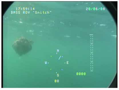
64 64

65 65

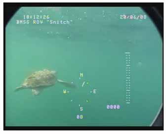
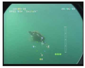
66 66
67 67

68 68

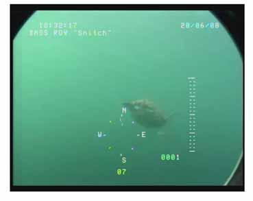
69 69

70 70

71 71
72 Figure 11: 72

73 Figure 12: 73

74 Figure 13: Turtle #34 diving to the sea floor 60 meters deep 74

75 Figure 13: Turtle #34 diving to the sea floor 60 meters deep continued 75

76 Figure 14: A turtle encounter with shark 76

77 Figure 14b: A 2 nd turtle encounter with a shark. Turtle was to the lower right corner eating a jelly and did not react to the shark. 77

78 Figure 15: Maps of monthly climatological sea surface properties in the Mid Atlantic Bight region. Row 1: temperature Row 2: density Row 3: salinity Row 4: chlorophyll-a concentrations derived from MODIS-Aqua satellite measurements of ocean color in Maps of monthly climatological sea surface properties in the Mid Atlantic Bight region. Row 1: temperature Row 2: density Row 3: salinity Row 4: chlorophyll-a concentrations derived from MODIS-Aqua satellite measurements of ocean color in

79 Figure 16: Vertical sections of temperature, salinity and density across the Mid Atlantic Bight shelf near 38.5 N for February and August. 79
.")
80 Figure 17: Satellite image of chlorophyll-a during F/V Kathy Ann (June 2008). Source: Sea-WiFS 8-Day 9-km products (NASA s GIOVANNI Ocean Color Time-Series Online Visualization and Analysis). Turtle survey track line is black and 50 turtle sightings are red circles. The shelf break is denoted by the heavy gray contour 80
81 Figure 18: Stroke rate, water temperature, and thermocline at depth during 60 m dive Count of Complete Stroke Cycles Kathyann Turtle-34 Profile of Dive from Surface to Ocean Floor (60m) Stroke Count & Water Temperature at Depth Thermocline strokes / meter Rate of Temp. Change (5 m) H2O Temp. C Depth (meters) Water Temperature C 81
82 Figure 19: Stroke rate, speed, water temperature, and thermocline at depth during 60 m dive Rate Kathyann Turtle-34 Profile of Dive from Surface to Ocean Floor (60m) Rates & Water Temperature at Depth Thermocline m/sec from surface m/sec from 5 m strokes / second Rate of Temp. Change (5 m) H2O Temp. C Depth (meters) Water Temperature C 82
83 Figure 20: Temperature profile during 60 m dive and benthic foraging 83

84 Figure 21: Temperature models for location and time 84
85 Figure 22: 85

86 Figure 23: Screen Captures of turtles defecating 86

87 Figure 24: Photo Gallery of Turtles Observed 87

88 88

89 89

90 90

91 91

92 92

93 93

94 94

95 95

96 96

97 97

98 98

99 99

100 100

101 101
102 102

103 103

104 104

105 105

106 106

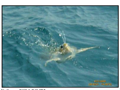
107 107

108 Figure 25: Examples used to calibrate visual distance estimates 108
109 Appendix A: Budget Data Compensation Collection Trips: F/V Kathy Ann September 24, 2006 Project share: $ 41, F/V Westport September 26, 2006 $ 43, F/V Celtic October 18, 2006 $ 37, Project Total: $122, Original Budget: $94,282 Actual Income: $122,077 Increase: $27,795 Budget for Revised project Plan Item Original Amount Obligated Remaining New Budget Personnel $ 30,680 $12,341 $18,339 $40,000 Travel $ 6,600 $ 1,000 $ 5,600 $ 8,000 Supplies $ 3,402 $ 2,100 $ 1,302 $ 8,000 Contractual $ 49,000 $26,500 $22,500 $60,000 Other $ 4,600 $ 4,100 $ 500 $ 6,077 Equipment $ 0 $ 0 $ 0 Totals $94,282 $46,041 $76,036 $122,
110 Appendix B: Trip Summary F/V Kathy Ann September 23-29, 2007 On Sunday, September 23 the F/V Kathy Ann departed Barnegat Light at 0800 heading Southeast on a search transect directly in line with Carteret Canyon. A charter fishing vessel returning from that canyon had spotted sea turtles in depths somewhere between 50 and 20 fathoms. At 2230 the vessel arrived at Station 1 (ROV 1, 23 fms) and commenced an ROV search dive. The standard protocol for this type of dive was to search the water column on the way down, search around the bottom, and search the water column on the way up to the surface. The search consisted of both video and sonar and a temperature logger was attached. At this station the combined wind and current created a drift rate of 1.2 knots which limited control of the ROV for searching particular spots on the sea floor. The substrate was sand and organisms present included sand dollars, scallops, hermit crabs, little skates, and four spot flounder. The dive ended at 2300; dive time 30 minutes. The vessel was anchored, using the starboard dredge, for the night. On Monday morning at 0830 operations commenced with Station 2 (ROV 2; 22.7 fms) while the vessel was still anchored up on the dredge. The wind was NE at knots, seas 2-3 feet, and it was sunny. The current was about 1 knot causing the vessel to drift at 0.2 knots. Twenty fathoms of dredge warp was paid out over the dive period to expand the search area. During the dive some excellent video of four spot flounder swimming behavior was taken. The dive ended at 0945; dive time 45 minutes. The vessel continued a surface search transect east, crows nest and foredeck manned with observers, and stopped at 1130 for Station 3 (ROV 3; 29.9 fms) inside the Hudson Canyon Scallop Access Area (HCA). Weights were attached to the tether about 25 m up from the vehicle to aid in tether management on the bottom dives. The wind was now ENE at knots, seas were 4 feet, and the sky was clear. The vessel conducted a standard ROV search pattern drifting at knots. The substrate was sand and shell hash and the sonar picked up recent scallop dredge tracks. Visually the towed area was identifiably different than patches of area that were not towed. The dive ended at 1215; dive time 45 minutes. The vessel now headed west on a visual surface search transect stopping at 1520 for Station 4 (Tow 1, 24.1 fms). The port dredge, a turtle dredge frame design with no turtle chains, was outfitted with two cameras and a temperature logger. Camera One was the NMFS low light Deep Sea Power and Light (DSPL) camera, recording to a mini DV tape. Camera One was attached to the bottom of the depressor plate viewing forward. Camera Two was a Panasonic H200 with wide angle lens, recording using a hard disk, attached near the gooseneck viewing back towards the dredge frame. The standard tow used 3 to 1 scope and a speed of 4 knots. During all tows the crows nest and foredeck were manned with observers. The winch was stopped during haulback at the 10 fathom mark to get video of the dredge flying in the water column. The tow time was 30 minutes; ending depth was 22.8 fms. Both cameras failed to operate during the tow. The battery in the H200 fell out and the cause of that problem was rectified. The cause of the DSPL malfunction was not obvious. Station 5 (Tow 2; 25.8 fms) started at The camera rig and the towing procedures were similar to the previous tow. Tow time was 30 minutes. It was late in the day so the video image of the H200 was dark. The DSPL again failed to operate. Station 6 (ROV 4; 24.3 fms) began at 1730 and lasted 30 minutes. This was a standard ROV dive drifting at 0.5 knots. The substrate was sand with sand dollars, scallops, and sulfur sponge ( Monkey dung ). Station 7 110
111 (ROV 5; 18.6 fms) started at 1830 and lasted for 45 minutes. The substrate was similar to the previous station. At 2104 the vessel anchored up for the night on the starboard dredge and began Station 8 (ROV 6; 26.9 fms). The dive lasted 30 minutes and the substrate was similar to the previous stations. On Tuesday morning, September 25 th, Station 9 (ROV 7; 27.2 fms) commenced at Scope was shortened on the anchored dredge in order to test the ability to spot the dredge using sonar. The BlueView sonar was set at the 50 m scale and was able to define the dredge clearly at a distance of 42 m. The ROV mounted video camera could just see the dredge at 8 m using natural light. When the ROV lights were turned on the visible range was greatly reduced, almost to zero, due to back scatter. A turtle eyes view of an oncoming dredge was video taped. Dive time was 60 minutes. Station 10 (Tow 3; 26.6 fms) began at The wind was SW at knots, seas were 3-5 feet with some whitecaps. The camera arrangements were similar to the previous tows except that the H200 was recording directly to the SD card and was set on auto-focus. The camera battery was taped into position to further secure from vibration effects. Both cameras functioned well on this dive which lasted 20 minutes. The tow was interrupted at 0945 with a turtle sighting (Turtle 1) 100 m off the starboard bow. The turtle, which had many barnacles on its carapace, dove as the vessel started hauling back the dredge. At 0949 the dredge was onboard and the vessel was lying too on top of the sighting area. There was a large amount of Sargassum weed floating on the surface and near the surface. At 1006 the ROV was in the water (Station 11; ROV 8; 26.7 fms) searching and examining the weed. Drift was 0.8 knots. The ROV dive ended after 40 minutes. At 1055 Station 12 (Tow 4; 26.7 fms) began towing over the sighting area. At 1105 the captain sighted Turtle 2, off the starboard bow from the pilot house; the turtle seemed to have black spots on its carapace. After a few seconds on the surface it dove and towing continued. At 1118 haulback began as the dredge seemed to have bogged down. The haul was stopped at the 25 fathom mark for two minutes and then the dredge retrieved relatively empty; tow time was 25 minutes. The DSPL battery died during the tow; the H200 had popped into pause mode upon setting over the rail. The vessel set out again (Station 13, Tow 5; 27.2 fms) in the same area at Wind was SW at 10-15, seas 2-4 feet, and it was sunny. At 1212 a large turtle (Turtle 3) was spotted from the crows nest ahead just under the sea surface. The vessel was taken out of gear and the dredge was left in the water. The ROV (Station 14, ROV 9) was launched off the port side at 1215 but the weights had to be taken off the tether. At 1216 the turtle was still visible, still just under the surface, astern of the vessel. At 1217 the turtle put its head above water for a few seconds. At 1220 we lost sight of the turtle as it dove before the ROV could reach its location. At 1225 the vessel hauled back 25 fathoms of warp and retrieved the ROV. At 1235 the ROV was redeployed off the stern. At this time it was noticed the ROV lost a propeller off one of its stern thrusters so it had to be brought back onboard to move a propeller from the side thruster to the vehicles stern. At 1254 a turtle was spotted, presumed to be Turtle 3, about 200 m off the port bow on the surface with its head up. The dredge was hauled and the vessel drifted down towards the turtle. At a distance of 100 m the turtle dove. The dredge was deployed for 55 minutes and the ROV for 20 minutes. Station 15 (Tow 6; 27.0 fms) began at At 1354 Turtle 4 was sighted on the surface 111
112 to port at about 300 m. Speed was reduced to 2 knots to get the vessel ahead of the turtle and then drift back but the turtle dove. At 1356 towing speed was resumed at 4 knots. The tow ended at 1415 after 30 minutes. Station 16 (Tow 7, 24.5 fms) began at 1555 with only the H200 camera in position due to problems with the DSPL camera. At 1615 Turtle 5 was sighted from the crows nest off the port side about 30 m out; and the vessel was taken out of gear. The turtle was the smallest of the day and dove quickly so the tow was resumed. At 1630 Turtle 6 was sighted about 200 m to port. It was a definite loggerhead, its head and carapace out of water, and then it dove. Wind was SW at knots, seas 3-4 feet and whitecaps. The sky was clear and there was a bright sun. The dredge was retrieved at 1635 for a tow of 40 minutes. Station 17 (Tow 8, 23.9 fms) began at 1645 and ended at 1715 for a tow time of 30 minutes with an end depth of 29.2 fms. The H200 camera was recording to the hard drive and tripped out upon setting. Station 18 (Tow 9, 29.1 fms) started at 1715 and lasted 30 minutes. The H200 recorded to the SD card. The vessel continued south on a surface search transect until dark and shortly thereafter arrived at a location that had previous turtle sightings; just west and outside of the intersection of the Elephant Trunk Scallop Access Area (ETA) and the HCA. At 2000 the vessel anchored on the starboard dredge and started Station 19 (ROV 10, 26.4 fms). The sand bottom had sand dollars, scallops, hermit crabs, a few cancer crabs, skate, and hake. One hake was observed digging itself into the bottom. Any shell sticking out of the bottom even a few inches was sighted on the sonar at least 15 m distant. The dive ended at 2100 for 50 minutes of dive time. On Wednesday, September 26 th, Station 20 commenced, a surface search transect, heading southwest. The wind was SW at 15-25, seas 3-5 feet, and a bright sun. The search direction was changed at 0832 to the northeast due to the viewing conditions; vessel speed was 8.5 knots. At 0850 a large dense mat of Sargassum weed was spotted along a drift line that included a lot of man-made flotsam. At 0907, on approaching the drift line, Turtle 7 was spotted with its head above the surface about 10 m off the port side; the turtle dove. At 0910 the vessel was drifting down through the Sargassum weed mat and launched the ROV (ROV 11; 26.3 fms). At 0917 Turtle 8 was sighted just under the surface from the crows nest; it was small, about 50 cm carapace, and was diving when sighted. At 0927 Turtle 9 was sighted from the crows nest. It was under the Sargassum weed off the port side. At this time the ROV was also under the weed, 50 m to starboard, observing many tropical species of fish (trigger fish, yellowtail, barracuda, etc). At 0930 another turtle was spotted (Turtle 10) below the surface to starboard. The weed made it difficult to maneuver the ROV towards the turtles. At 1000 the ROV completed a surface to seafloor search; the sand substrate was almost devoid of life. The ROV was brought aboard so the vessel could reposition to drift through the weed patch again. At 1005 another turtle sighting was made (Turtle 11) though there was no way to determine if each sighting was a new turtle or a re-sighting. At 1010 two turtles (Turtle 12 and Turtle 13) were sighted at the same time within 5 m of each other. At 1040 Turtle 14 was sighted. At 1115 the ROV was brought aboard and the vessel again repositioned. The vessel conducted another drift through the weed searching with the ROV and visually and did not see any turtles. The station ended at 1155 with about 120 minutes of ROV dive time. Station 21, starting at 1200, was a surface search transect north to the location of the Turtle 6 sighting. The track was just to the west of the HCA boundary. No Sargassum weed or turtles were spotted and the transect ended at Station 22 (Tow 10, 23.3 fms) began at 1351 with 112
113 both cameras mounted. At 1415 Turtle 15, a large loggerhead, was spotted dead ahead from the crows nest at about 300 m. The turtle was first observed submerged rising to the surface. It was on the surface for less than a minute before diving when the vessel was about 50 m away. The tow ended at 1428 for 38 minutes of tow time. Station 23 was a search transect heading north over yesterday s turtle sightings starting at At 1437 Turtle 16 was sighted from the crows nest about 30 m off the port floating on the surface with its head out of water. It was about 50 cm in carapace length and dove immediately. At 1440 the transect was resumed and at 1510 the vessel altered course to the west. Wind was from the SE at knots, seas were 5-6 feet and building. The F/V Kathy Ann was heading to meet a day boat scalloper bringing out replacement ROV parts. At 1530 Turtle 17 was spotted from the foredeck off the starboard beam at about 100 m. It dove within seconds of being sighted. At 1615, the ROV operator, looking over the rail from the lower aft deck, spotted Turtle 18 passing close to port, about 10 m away. At this time the decision was made to end the transect due to weather. The parts were received from the other vessel and the decision made to head into Barnegat Light for the night. The vessel arrived at On Thursday, September 24 th, Station 24 commenced at 0930 upon departing the sea buoy off Barnegat Light. The vessel proceeded on a NE heading towards the inshore western side of the Mud Hole ; the name given to the shallow portion of the Hudson Canyon. The inshore weather was overcast, winds SW at 15 knots, seas 2 feet. Offshore vessels were reporting heavy weather. The search transect ended at Station 25 (ROV12, 20.8 fms) began at 1230 on scallop grounds to the west of the Mud Hole. The drift rate was 0.7 knots. The substrate had sand waves and did contain scallops. The water was very murky and visibility poor. The dive ended after 30 minutes. Station 26 (Tow 11, 22.6 fms) began at 1305 and lasted 17 minutes. This was to test to see what degree of visibility the dredge cameras would have under these conditions. The DSPL was now mounted to view through a hole cut in the depressor plate. Station 27 was a surface search transect starting at 1330 and heading SE to an area where the F/V Nelson Blount, a scallop boat, was fishing and sighting turtles. At 1827 we sighted Turtle 19 from the crows nest. The small turtle was about 30 m ahead and dove immediately. This was the location identified by fishermen on the F/V Nelson Blount as having turtles. The transect ended at this time. Station 28 (ROV 13, 24 fms) started at The vessel was positioned to drift over the turtle sighting and the tow the F/V Nelson Blount was working. Wind was SW at 15-25, seas 4-5 feet, and the sky was cloudy. At 2030 the vessel repositioned to drift through the site again as the current was changing. At 2100, ROV 14 dive began on the same station. The bottom substrate was sand with a thick shell hash. In addition to sand dollars and scallops there were many hake and sand eels. At 2215 the station ended, with 180 minutes of dive time, and the vessel was anchored on the starboard dredge for the night. On Friday morning, September 28 th, Station 29 (ROV 15, 23.7 fms) began at 0720 while the vessel was still anchored on the dredge. The wind was SW at 15-20, seas were 6-7 feet. The substrate was thick shell hash and the sonar picked up many dredge tracks which were difficult to define from visual observation. The dive ended after 40 minutes. 113
114 Station 30 (ROV 16, 24.0 fms) was a test of the ROV in a towed mode of operation. The tether was attached by electrical tape to a towing line (cod end twine) in loose bights and the ROV deployed off the stern. The ROV settles in at a depth of 15 feet as the F/V Kathy Ann maneuvered astern of the F/V Nelson Blount. At 0920 the vessel was towing the ROV about 400 m behind the F/V Nelson Blount dredges when many targets were spotted on the BlueView sonar at about m. The targets were identified visually at 13 m as sharks. A school of tuna, spotted first on the sonar, was visually identified on the video. The sharks and tuna were feeding on the discarded catch and shucking discard of the Blount. The discarded catch was observed on the sonar and visually when the Blount cleared its deck right after a tow. The F/V Kathy Ann was maintaining 4.5 knots with the ROV under tow without difficulty. More tether was set out to allow the vehicle to go deeper in the water but only to a limited extent as there was a risk of damaging the tether. At 0939 Turtle 20 was observed from the crows nest about 30 m off the starboard side. The turtle came up to the surface and then dove quickly. At 1114 Turtle 21 was spotted from the crows nest sitting on the surface about 100 m to starboard. The ROV operations ended at 1130 with 150 minutes of dive time. Station 31 (ROV 17, 24.6 fms) started at The F/V Kathy Ann was anchored on one dredge and asked the F/V Nelson Blount to pass close aboard. After that vessel passed the F/V Kathy Ann drifted over the Blount s tow path; the drift rate was 0.5 knots. No fish, crabs, or turtles were found feeding in the tow path. An occasional shucked scallop shell, with meat attached, was observed. The tow path was observed at the location the previous observed turtle was spotted. At 1251 Turtle 22 was observed; it popped up above the surface 100 m off the starboard quarter then dove almost immediately. The ROV was being hauled at that time for a total dive time of 40 minutes. Station 32 (Tow 12, 25.2 fms) was started at 1310 with the intent of towing in the area where turtles had been observed. The tow lasted 25 minutes, both cameras working, but no turtle observed. At 1351 Turtle 23 was observed from the foredeck 100 m to starboard on the surface for about 30 seconds. Station 33 (Tow 13, 23.2 fms), started at 1357, covered the location of the last turtle sighting and was conducted as a turn around tow with multiple short passes. The tow ended at 1435 for 38 minutes of tow time. Station 34 (ROV 18, 23.7 fms) started at The vessel was anchored over the Tow 13 location. At 1530 sharks and tuna were observed at a depth of 20 m, on sonar and video, feeding on scallop viscera and other dredge discard being thrown over the side. The dive ended at 1600 with 60 minutes of dive time. Station 35 (Tow 14, 22.0 fms) started at 1615 and lasted 30 minutes. The vessel heading was 240 degrees and speed was 4 knots. The wind was NW at knots, a wind wave of 2-3 feet, and a long SW swell of feet. The sun was very bright. Station 36 was a search transect heading towards the area Turtle 1 had been sighted. At 1803 the vessel was at this location and then proceeded south along a transect crossing the area where turtle 2-5 were sighted. The transect ended at 1837 when the sun set without any turtle sightings. The vessel was anchored on the dredge and conducted Station 37 (ROV 19, 26.1 fms) starting at The station ended at 1952 after 70 minutes of dive time. During the night the wind and seas increased and at 0300 Saturday, September 29 th, the vessel began to jog towards Barnegat Light. The F/V Kathy Ann arrived at the dock at 1030 and ended the cruise. 114
115 Appendix C: Trip Summary F/V Kathy Ann We left Barnegat Light at 2000 on June 16, 2008 on The F/V Kathy Ann. We steamed all night to the Northwest corner of the Elephant Trunk Area (ETA). At 0630 we began Transect 1 ( , ; HEADING 097, speed 6 knots; depth 28 fathoms). Wind was west at 15 knots and seas were 2-3 feet. The sky was clear and sun glare was a problem. At 0752 we sighted a loggerhead from the pilothouse 100 m off the starboard bow (Station 1, Turtle 1) on the surface ( , ) and launched the ROV (Dive 1). At 0814 the ROV was within 10 feet of the turtle but did not capture the turtle on video. This was a very large barnacle encrusted loggerhead that was hanging out on the surface when approached. It dove a few feet and then was lost in the sun s glare. The wind was now 20 knots from the west and seas 3-4 feet with whitecaps. We were drifting at 1.1 knots. There were many salps and jellies in the water near the surface we continued a surface search for Turtle 1 without re-sighting. 0845: Resumed Transect 1 ( , , heading 140T). 1005: Sighted Turtle 2 from the masthead (Station 2, , ). Scallop boats were in the area. ROV (Dive 2) in the water. 1011: Lost visual contact with Turtle 2 due to sun glare. 1036: ROV (Dive 3) sent to bottom for search ( , , 25 fathoms). 1117: Ended ROV dive as there was too much drift to reach the bottom due to the short tether. 1120: Resumed Transect 1 ( , , heading 180). 1150: Sighted Turtle 3 from the masthead 200 m to starboard and 4-5 feet under the surface (Station 3, , , 26 fathoms). Wind was west at 20 knots, seas 3-5 feet. ROV (Dive 4) in the water and Turtle 3 was acquired on video. 1215: Lost contact with Turtle 3; retrieving ROV. Resumed Transect 1 ( , , heading 180) 1250: Turtle 4 sighted from masthead 600 feet off starboard and underwater (Station 4, , , 28.5 fathoms); ROV launched (Dive 5). 1300: Lost turtle after getting some video; diving to bottom to search. 1320: Terminated dive ( , ). Resumed Transect 1 heading 180 degrees. Wind dropped to knots, seas 2-3 feet. 1330: Turtle 5 spotted from foredeck 500 feet to port (Station 5, , ) ROV launched (Dive 6, 26 fathoms, drift 0.6 knots) Initially acquired then lost turtle; too far from vessel. Then Turtle 6 showed up; definitely a different turtle (Station 6, , , depth 25 fathoms). Acquired on video but at 1350 lost contact with the turtle when the tether got caught on the vessels rudder ROV dive to the bottom (Dive 7, , , depth 27 fathoms) 1515: Terminated dive 7; resumed Transect 1 ( , ) 1530: Spotted Turtle 7 (Station 7, , and the ROV was launched (Dive 8). While the ROV was tracking Turtle 7 another turtle, Turtle 8, was observed off to starboard from the masthead.1600:still tracking Turtle 7 which is heading in a northerly direction by taking short surface breathing breaks and shallow dives ( , ). 1618: Lost ROV contact with Turtle 7 when we ran out of tether. At that time, Turtle 7 had just taken surface breaths and dove to 11 m, and leveled off ( , ). 1625: Resumed Transect 1 ( , ). Turtle 7 still visible on surface as we proceed down transect. 1644: Sighted Turtle 9 from foredeck (Station 8, , , depth 28.5 fathoms) 1649: 115
116 ROV (Dive 9) in water; turtle acquired on video. 1700: Lost contact with Turtle 9 due to short tether ( , ) 1702: ROV onboard; resumed Transect : Turtle 10 sighted from off to port from foredeck (Station 9, , ) 1732: ROV (Dive 10) in water but too far away; the turtle was acquired on video but soon lost. 1744: Lost visual contact with Turtle 10 which was still visible on surface up to this point ( , depth 28.9 fathoms) Sent ROV down to do bottom search. The vessel was drifting at 0.3 knots. 1800: Ended Dive 10 ( , : Resumed Transect : Spotted Turtle 11 at the last minute and ran over its location and it dove (Station 10, , ) Very poor searching conditions due to glare so ended Transect : Anchored up for ROV Dive 11 which was a surface to bottom search ( , ). We then proceeded at end of dive to DelMarVa area. June 18, : Started Transect 2 in DelMarVa Area ( , , Heading 240, speed 6 knots) Weather sunny wind NW 20 knots, seas 3-4 feet. 0753: Turtle 12 sighted from masthead off starboard beam close aboard and underwater and heading north (Station 11, , , depth 27 fathoms). 0755: ROV (Dive 12) launched and approached turtle from rear. Turtle 12 seemed smaller than turtles yesterday. It dove out of sight. 0806: Resumed Transect : Sighted very large white shark that swam right up to the vessel; it was probably 15 to 18 feet long and would eat turtles like cheetos. 0844: Turtle 13 sighted from masthead off the port side, close aboard and underwater (Station 12, , , 27 fathoms). Glare was very bad for sightings. 0850: ROV (Dive 13) launched. Turtle 13 was right off the bow and took a series of breaths then dove. It leveled off at about 10 m depth and was barely visible from the rail directly above. This was a turtle as large as the ones sighted yesterday but seemed much more skittish. The turtle was heading north when sighted but we could not acquire on the ROV. Our vessel drift was 0.6 knots at 146 degrees. 0904: ROV onboard; resumed Transect : Turtle 14 sighted from foredeck 100 m off port beam on surface (Station 13, , , depth 30.5 fathoms). ROV (Dive 14) launched. The turtle was acquired on video but dove quickly and was lost. 0929: Sending ROV to the bottom. Drift 0.6 knots, 164 degrees. We observed the ROV go down and lost visual contact from the vessel rail at a depth of 10 m. 0950: Retrieved ROV. 0955: Resumed Transect 2 ( , , depth 30.5 fathoms) 1000: Turtle 15 sighted on surface from pilot house on surface 200 m off port bow. SW wind knots, seas 2-3 feet (Station 14, , , depth 31 fathoms). 1005: ROV (Dive 15) launched. The ROV acquired the turtle on video and the turtle approached the ROV and head butted the ROV. 1015: Still tracking turtle 15 now heading north ( , ). 1026: Still tracking ( , ). 1037: Still tracking ( , , depth 31.3 fathoms). Vessel drift 0.5 knots, 160 degrees; vessel using engines to stay with turtle. 1054: Backed off from turtle 15 to test range of sonar and was able to view turtle on sonar to the end of the 35 m range. 1103: Retrieved ROV ( , ). Resumed Transect
117 1110: Turtle 16 spotted off starboard bow from foredeck; lost and recovered in glare (Station 15, , , depth 32 fathoms). 1114: Launched ROV (Dive 16). 1119: Could not acquire the turtle; glare really bad so it is hard to direct the ROV. Retrieved ROV. 1122: Resumed Transect 2 (( , ). 1150: Have caught several quick glimpses of turtles on the surface. 1209: Spotted Turtle 17 from the masthead deep underwater but could not locate again due to glare ( , ) 1300: Ended Transect 2 ( , ). 1300: Started Transect 3 ( , , depth 31.3 fathoms). Wind NW knots, seas 2-3 feet. 1309: Turtle 18 sighted from the masthead was just off the port bow. The vessel came close and the turtle dove (Station 16, , , depth 30.8 fathoms). 1312: Launched ROV (Dive 17). 1317: Turtle never re-sighted. Retrieved ROV; resumed Transect : Turtle 19 spotted from masthead on surface off the starboard side about 500 m out ( , , depth 30.1 fathoms). It dove during our approach. 1334: Resumed Transect : Turtle 20 spotted on surface from masthead ( , , depth 29.8 fathoms). It dove as the vessel approached. 1350: Resumed Transect : Turtle 21 sighted from masthead on surface 500 m off to starboard. Brought vessel to 100 m out and launched the ROV Dive 18 (Station 17, , , depth 29.8 fathoms). The ROV acquired the turtle. 1401: While tracking Turtle 21 a second turtle, Turtle 22 entered the area on the opposite side of the vessel ( , , depth 29.8, vessel drift, 0.6 knots 189T). 1410: Turtle 21 dove deep and contact lost at 16 m depth ( , ). 1418: ROV searching deep when two turtles visually spotted off the starboard side then dove. 1420: ROV going to the bottom. 1429: Two turtles visually spotted again. 1433: ROV Dive 18 back on deck; repositioning vessel to pursue Turtles 21 & 22 ( , ). 1435: Repositioned on Turtles 21 & 22 location; turtles; turtles are frequently diving and surfacing. We are searching visually but lost contact. 1442: Resumed Transect 3 ( , ) 1444: Sighted a turtle but it dove; resumed transect. 1455: Sighted at least two more turtles, Turtle 23 and Turtle 24, ( , , depth 29.6 fathoms). The turtles are not spending much time on the surface and seem very skittish. Wind is SW at knots. 1500: Resumed Transect : Turtle 25 sighted from masthead 500 m ahead on surface. When 30 m out from the vessel we launched the ROV (Dive 19) but the splash caused the turtle to dive. (Station 18, , , depth 28.1 fathoms). 1527: Turtle 25 spotted visually about 5 m deep near vessel; ROV still searching deep. Drift 0.4 knots, 143T. 1532: ROV acquired Turtle 25 and tuna school. Another Turtle 26 sighted on bow. 1540: Lost contact with Turtle 25 ( , ). Turtle 25 spotted visually beyond reach of tether; Turtle 26 no longer in sight. 1550: Retrieved ROV (Dive 19) and resumed Transect 3 ( , : Three turtles spotted ahead (Turtles 27, 28, 29) on surface but diving frequently; ROV (Dive 20) in water (Station 19, , , depth 27.8 fathoms). No visual on turtles. Drift 0.4 knots, 270T. 1623: No contact with turtles spotted to north and out of tether range; retrieving ROV. 1624: Resumed Transect 3 ( , ). 1637: Turtle 30 spotted 500 m ahead on surface from masthead (Station 20, , , depth 25.8 fathoms) Positioning vessel 100 m upwind. ROV (Dive21) launched and Turtle
118 acquired. 1641: Lost contact under vessel. SW wind 20 knots, seas 3-4, extreme sun glare making operating conditions difficult. 1652: ROV retrieved and resumed Transect 3 ( , ). 1725: Turtle 31 sighted off the starboard bow, took 3 breaths and dove, and then came back up (Station 21, , , depth 21.3 fathoms). 1732: Launched ROV (Dive 22); no contact so diving to bottom to search. Drift 0.9 knots, 330T. 1740: While ROV on bottom turtle sighted on surface to the north. 1752: Retrieved ROV and resumed transect at 025 degrees ( , ). 1758: Sighted Turtle 32 on surface taking breaths 300 m out and maneuvered vessel towards the turtle. 1800: Launched ROV Dive 23 (Station 22, , , depth 23.5 fathoms). 1805: Turtle 32 acquired by ROV. The turtle was swimming steady facing north just under the surface. 1811: Ran out of tether so lost contact with turtle; lost visual in the sun s glare. We could not maneuver vessel to a better sighting angle ( , ) Drift 1.0 knots, 344T. 1819: Turtle briefly seen by ROV during retrieval. 1823: ROV (Dive 23) back on deck Resumed Transect 3 at 025T ( , , depth 22.1 fathoms) Wind SW 20 knots, seas 3-4 feet. 1912: End Transect 3; visibility not good for sighting ( , ). June 19, : Started Transect 4 along the west boundary of the Hudson Canyon Access Area (HCA) on the open bottom ( , , depth 27.1 fathoms). Wind was W knots, seas 4-6 feet, partly cloudy. Sighting conditions were poor. 0750: Heading 065T ( , , depth 28.3 fathoms) Three scallop boats working off to port. 0830: Turtle 33 sighted from masthead 100 m off port side on surface ( , , depth 28.6 fathoms). 0840: ROV (Dive 24) in water but not functioning. Turtle 33 still on surface; is a small loggerhead. We lost sight of turtle. 0900: ROV is functioning so started to rig for towing. Wind W 20 knots, seas 4-6 feet. 0904: Turtle 34 sighted from foredeck 50 m to port on surface (Station 24, , , depth 29 fathoms). 0905: ROV (Dive 25) launched; small loggerhead turtle acquired. 0912: Tracking Turtle 34 ( , , 29 fathoms) Drift 0.5 knots, 079T. 0920: , , 28.6 fathoms. SW wind 15 knots, seas 3-4 feet. 0926: Lost turtle; tether at limit ( , ). Turtle still visually observed on/near surface. 0931: Re-acquired with ROV ( , ). 0941: , ; maneuvering with vessel engines to keep ROV on turtle. 0955: , ; 28.8 fathoms. Turtle 34 is 50 m from port beam and is less than 1 m down; barely visible from pilot house/foredeck but very visible from masthead. 1000: Still tracking Turtle 34 (ROV Dive 25) , ; drift 0.5 knots, 070T; the turtle is oriented north. 1007: Lost ROV contact with turtle, tether fully extended (120 m). Turtle reacquired on surface visible 100 m out from pilot house. Wind W at 10-15, seas 2-3 feet. 1012: , Turtle 34 is 50 m to port and 3 m down and is barely visible from masthead. 1020: , : , , Drift 0.6 knots, 100T. 1041: , Drift 0.4 knots, 165T. Several scallop boats working 3 miles out. Wind 10 knots, seas 2 feet. 1050: , : , In two hours Turtle 34 moved nm, 070T. 118
119 1113: Turtle 34 eating salps and other jellies at 10 m ( , ) The current is from the north; the turtle orients into the current and eats the tinifores that come close by and does not alter course to feed on larger or more abundant prey. 1122: , : , : Turtle 34 making a deep dive and was lost at 11 m ( , Drift 0.5 knots, 032T. ROV went down to search the bottom. 1200: Searched bottom and came up conducting sonar 30 m and 10 m ( , , depth 28.6 fathoms). Turtle is nm bearing 065T from original sighting. 1205: Retrieving ROV (Dive 25). 1207: Re-sighted Turtle 34 on surface visually from vessel 800 m to port. 1225: Turtle 34 alongside v vessel hanging out while ROV operator is on break ( , , depth 28.8 fathoms). 1234: ROV (Dive 26) launched and Turtle 34 acquired ( , ). 1246: ROV lost turtle but turtle still visible on/near surface. 1247: Acquired ( , ). Turtle 34 has moved about 200 feet in past hour. 1340:ROV lost contact with Turtle 10 m depth but masthead observer could still see the turtle (and ROV) so when the turtle came up to the surface the ROV re-acquired at 1343 ( , ). 1357: , : Turtle 34 and ROV on the sea floor; the ROV is being dragged away from the turtle due to the drift and short tether ( , , depth 28.3 fathoms). 1420: Retrieving ROV; conducting visual surface search for the turtle. 1430: ROV on deck; returning to last position of Turtle : Visually located Turtle 34 ( , , 28.5 fathoms) but the ROV crew was on break. 1459: ROV (Dive 27) launched and acquired Turtle 34 ( , ). 1515: Turtle nm from 0900 position ( , : Lost both visual and ROV contact with the turtle; strong glare. 1530: Retrieving ROV when Turtle 34 spotted visually 400 m ahead ( , ) Re-launched ROV (Dive 28) and acquired Turtle 34 ( , ). 1538: Lost turtle again; too much glare. The ROV was sent back down to the bottom. 1552: ROV coming back up to surface. 1557: ROV surfaces with Turtle 34 coming up next to it ( , ). 1610: , : , At this time, Turtle 34 was nm due N from original position. 1645: ROV runs out of tether; turtle remains visible from vessel at or near surface. 1652: Lost visual contact in glare; ROV on deck. 1712: ROV (Dive 29) going to bottom ( , , depth 29 fathoms). 1720: ROV on way back up to surface; tether too short to control ROV movement on bottom. 1726: ROV on deck ( , ). We are rigging ROV to be towed. 1756: ROV (Dive 30) rigged for towing and launched ( , ) 1800: Towing ROV with 50m of tether married to ½ inch polypro line at 4 knots and maintained 6 m depth. 1836: Completed ROV tow test. The ROV was back on deck. 1840: Resumed search Transect 4 north ( , ). By this time there were four scallopers working the open bottom west of the HCA where we spent today tracking. 1930: End Transect 4 ( , ) June 20, : Started Transect 5 in the ETA ( , , depth 28.5 fathoms) Wind variable at 5 knots, seas 1-2 feet. 0749: Sighted Turtle 35 from foredeck on surface 300 m off starboard beam ( , , 25.5 fathoms). Turtle 35 is a large loggerhead and was facing west and dove when the vessel came within 100 m. Drift 0.3 knots, 334T. This sighting was on top of one of the sightings earlier in the trip. 0805: Turtle 35 did not resurface so resumed Transect
120 0830: Turtle 36 sighted from the pilot house off the starboard beam about 200 m out. Altered course to intercept and the turtle dove. Possibly a different turtle spotted 500 m out to starboard and we located the vessel over the location. 0840: The turtle was visually observed 5-10 m down ( , , 27.5 fathoms). Drift 0.2 knots, 000T. 0845: Launched ROV (Dive 31) to bottom for search ( , ) 0913: ROV on deck; turtle re-sighted visually about 2 m down and 75 m off stern. Vessel is maneuvering to launch. 0920: ROV (Dive 32) launched; the turtle is still visible 5-10 m down. 0925: ROV could not acquire and retrieved ( , , 27.5 fathoms). 0930: Resumed Transect : Turtle 37 spotted from masthead 100 m starboard qtr underwater; sighted several times ( , , 27.5 fathoms). 0941: Resumed Transect : Sighted Turtle 38 from masthead off to starboard 50 m and underwater (Station 26, , ). 0950: Launched ROV (Dive 33) and tried to direct from masthead but the turtle was lost in the glare. 0958: Retrieved ROV. We resumed Transect 5 on reverse heading; 000T. 1000: On Transect 5 ( , ). 1023: Turtle 39 spotted from foredeck 600 m off starboard bow on surface. 1026: Launching ROV (Dive 34) , , 26 fathoms. 1028: Turtle 39 acquired by ROV. 1034: , Drift 0.4 knots, 045T. 1045: , : , : , Drift 0.3, 017T. 1115: , : , : , : , : Lost contact with turtle when ROV tether got caught on bow. ( , ) Turtle 39 still under visual observation from vessel ; directing ROV to turtle. 1207: Turtle 39 re-acquired by ROV ( , ). 1217: , : , : , : , : Turtle 39 is at 10 m depth feeding for the first time since being acquired. 1330: , : , Wind SW knots, sea 1-2 feet, sunny. 1400: , Turtle 39 has been heading NE 1.2 nm since start of tracking. 1402: Turtle 40 sighted off bow 500 m away. Drift 0.4 knots, NE. 1405: The two turtles are now about 500 m apart and facing different directions. 1410: , Turtle 40 still 300 m to starboard. 1423: , : , Drift 0.3 knots, 013T. 1445: , : , : , Turtle 39 has moved nm, 070T. The turtle is feeding at 10 m on salps and jelly fish. 1523: , : , Lost contact with Turtle 39 at 30 m during a dive; could not keep up. 1544: Turtle 40 still visible off starboard side. ROV comes up to surface and Turtle 39 re-acquires the ROV. 1550: ROV following Turtle 39 ( , ). 1603: , : Turtle 40 coming closer to Turtle 39 ( , ) 1636: Lost contact when Turtle 39 dove and tether went tight. 1650: Retrieving ROV; strong glare making visual sighting very difficult ( , ) Turtle 39 covered nm heading 055T since first contact. We are searching for Turtle : ROV (Dive 35) acquires Turtle 41; a small loggerhead ( , , 25.5 fathoms). Drift 0.2 knots, 300T. 1722: , : Turtle 41 avoids a shark ( , ). 1752: , : , Drift 1.0, 353T. Turtle 41 has 120
121 gone 1.0 nm since acquired. 1836: Turtle 42 observed visually 20 m off to starboard; large loggerhead covered with moss ( , ). Turtle 43 observed at the same time right off bow. 1900: Ended Tracking ( , ). June 21, : Lying too ( , ) Drift 0.7 knots at 328T. Wind SW 15 knots, seas 2-3 ft, overcast. 0730: Commenced Transect 6 to the NW ( , , 26.5 fathoms). 0830: , , 25.3 fathoms. The wind is SW 20 knots and there are rain squalls. 0845: Altered Transect 6 to 070T ( , , 24.3 fathoms). 0925: Sky clearing; ocean changing from grey/brown to blue ( , ). 0945: Altered Transect 6 to 180T ( , , 24.6 fathoms). 1006: ( , , 26.0 fathoms) Wind SW 20 knots, seas 3-5 ft, heading 180T at 4.5 knots. 1015: Spotted Turtle 44 from foredeck; it was astern to starboard with head above surface and then dove. Vessel came about to search (Station 29: , ). 1020: Launched ROV (Dive 36) and acquired Turtle 44; a small loggerhead ( , ). 1024: Startled Turtle 44 and it dive down. The ROV lost sight of the turtle and continued to the bottom to search ( , Turtle 44 s evasive maneuver was a straight down dive. 1025: ROV at 38 m depth; can t reach bottom due to short tether. 1029: Turtle 44 spotted back on surface; ROV on the way up. 1035: Turtle dives again and we lost visual contact; the ROV tether is fouled on vessel rudder. 1041: Retrieving ROV ( , ). 1047: Resuming Transect 6 south on a heading of 180T; wind SW knots, seas 2-3 ft, hazy sun. 1055: Altered Transect 6 to the north for better sighting conditions. 1057: Spotted Turtle 45, much larger than previous Turtle 44. Sighted from pilot house dead ahead 200 m, and then dove ( , ). 1103: Did not relocate; back on Transect : Turtle 46 spotted from masthead 300 m ahead on surface. The turtle dove when the vessel was 200 m out ( , , 25.1 fathoms). The turtle was facing south when observed. Drift 1.0 knots, 000T. 1130: Altered track to 270T ( , ). 1137: Turtle 47 observed ahead but dove right away ( , , 24.3 fathoms). The turtle was facing the vessel; observed the vessel when we were 150 m away, and dove right away. 1155: ( , , 25.3 fathoms) Heading 235T. 1209: Turtle 48 spotted from pilot house and masthead 100 m to starboard, looked at vessel then dove (Station 30, , ). 1210: The vessel is laying too; sighted Turtle 48 just under surface as we approached. 1215: ROV (Dive 37) launched but turtle is hard to locate due to pour visual. 1218: ROV acquires the turtle ( , , 25.0 fathoms). 1222: ROV can not see the turtle well and contact is lost but the turtle is still visually observed from vessel 3-5 m down near the vessel. 1232: ROV operator says visibility is poor; retrieving ROV ( , ). 1241: Resumed Transect 6 NW ( , , 25.0 fathoms). 1300: Turtle 49 spotted on surface from pilot house out 100 m off starboard bow; small in size (Station 31; , , 24.5 fathoms). 1305: Launched ROV (Dive 38) and acquired turtle. The ROV then got to close and the turtle tilted to present its shell to the ROV. 1315: Lost ROV contact with turtle but the turtle remained visible from the vessel ( , ). 1320: Lost all visual contact with turtle; bad sighting conditions ( , , 24.6 fathoms). 121
122 1324: Resumed Transect 6 NW ( , , 24.3 fathoms). 1330: Turtle 50 sighted from masthead 300 m out on surface but dives before we get close ( , , 24.3 fathoms). 1350: On Transect 6 ( , , 23.1 fathoms). 1420: End Transect 6 for ROV Dive 39 ( , , 21.9 fathoms). 1425: Launched ROV (Station 32); drift 0.4 knots, 000T. 1500: ROV dive completed. The water was turbid, no jelly fish or salps observed, and there were many benthic invertebrates on the bottom ( , , 20.0 fathoms) Drift 1.0 knots, 065T. 1505: Resuming Transect 6 north. 1555: ( , , 19.8 fathoms) proceeding at 7.2 knots, 000T. 1630: End Transect ( , : Arrived back at Barnegat Light. 122

123 Appendix D: Track Plots 123

124 124

125 125

126 126

127 127

128 128

129 129

130 130

131 131
Sea Turtle Oceanography Study. Matthew Weeks, Ronald Smolowitz, Ruth Curry Coonamessett Farm Foundation Inc
 Sea Turtle Oceanography Study Final Progress Report for 2009 Sea Scallop RSA Program NA09NMF4540131 June 2010 By Matthew Weeks, Ronald Smolowitz, Ruth Curry Coonamessett Farm Foundation Inc In Collaboration
A Sea Turtle's. by Laurence Pringle illustrated by Diane Blasius
 A Sea Turtle's by Laurence Pringle illustrated by Diane Blasius It was a summer night on a Florida beach. A big, dark shape rose out of the ocean and moved onto the shore. It was Caretta, a loggerhead
Response to SERO sea turtle density analysis from 2007 aerial surveys of the eastern Gulf of Mexico: June 9, 2009
 Response to SERO sea turtle density analysis from 27 aerial surveys of the eastern Gulf of Mexico: June 9, 29 Lance P. Garrison Protected Species and Biodiversity Division Southeast Fisheries Science Center
from an experimental bag net SHIODE, DAISUKE; TAKAHASHI, MUTSUKI Proceedings of the 6th Internationa SEASTAR2000 workshop) (2011): 31-34
 (2011): 31-34") Development of sea turtle releasing Titlenet/pound net fisheries 2 - practic from an experimental bag net SHIODE, DAISUKE; TAKAHASHI, MUTSUKI Author(s) FUXIANG; TOKAI, TADASHI; KOBAYASHI, ABE, OSAMU Proceedings
Development of sea turtle releasing Titlenet/pound net fisheries 2 - practic from an experimental bag net SHIODE, DAISUKE; TAKAHASHI, MUTSUKI Author(s) FUXIANG; TOKAI, TADASHI; KOBAYASHI, ABE, OSAMU Proceedings
Developing a Salmon Excluder for the Pollock Fishery
 Developing a Salmon Excluder for the Pollock Fishery -A cooperative research project- NMFS Race Division and the North Pacific Fisheries Research Foundation John Gruver United Catcher Boats Association
SEA TURTLE CHARACTERISTICS
 SEA TURTLE CHARACTERISTICS There are 7 species of sea turtles swimming in the world s oceans. Sea turtles are omnivores, meaning they eat both plants and animals. Some of their favorite foods are jellyfish,
2008/048 Reducing Dolphin Bycatch in the Pilbara Finfish Trawl Fishery
 2008/048 Reducing Dolphin Bycatch in the Pilbara Finfish Trawl Fishery PRINCIPAL INVESTIGATOR: Prof. N.R. Loneragan ADDRESS: Centre for Fish and Fisheries Research Biological Sciences and Biotechnology
Exceptions to prohibitions relating to sea turtles.
 223.206 Exceptions to prohibitions relating to sea turtles. (d) Exception for incidental taking. The prohibitions against taking in 223.205(a) do not apply to the incidental take of any member of a threatened
Design Evolution of a Turtle Excluder Dredge for the Northwest Atlantic US Sea Scallop Fishery
 Design Evolution of a Turtle Excluder Dredge for the Northwest Atlantic US Sea Scallop Fishery Ronald Smolowitz* Coonamessett Farm, Inc, 277 Hatchville Road, East Falmouth, Massachusetts, 02536, USA Matthew
BBRG-5. SCTB15 Working Paper. Jeffrey J. Polovina 1, Evan Howell 2, Denise M. Parker 2, and George H. Balazs 2
 SCTB15 Working Paper BBRG-5 Dive-depth distribution of loggerhead (Carretta carretta) and olive ridley (Lepidochelys olivacea) turtles in the central North Pacific: Might deep longline sets catch fewer
DEEP SEA TD/RES 113 SOUTHEAST ASIAN
 2007 Standard Operating Procedures of DEEP SEA BEAMTRAWL SAYAN Promjinda SUTHIPONG Tanasarnsakorn TAWEESAK Timkrub NARONG Reungsivakul SOMBOON Siriraksophon SOUTHEAST ASIAN FISHERIES DEVELOPMENT CENTER
Teacher Workbooks. Language Arts Series Internet Reading Comprehension Oceans Theme, Vol. 1
 Teacher Workbooks Language Arts Series Internet Reading Comprehension Oceans Theme, Vol. 1 Copyright 2003 Teachnology Publishing Company A Division of Teachnology, Inc. For additional information, visit
Are my trawl wires marked correctly? Is my trawl spread optimally? Is the trawl on bottom?
 TRAWLMASTER Are my trawl wires marked correctly? Is my trawl spread optimally? Is the trawl on bottom? Trawlmaster is a wireless trawl monitoring system that provides complete trawl geometry. This is one
SUMMARY OF THE PUBLIC HEARINGS ON SCOPING DOCUMENT FOR AMENDMENT 31 SEA TURTLE/LONGLINE INTERACTIONS (WITH ATTACHMENTS)
") SUMMARY OF THE PUBLIC HEARINGS ON SCOPING DOCUMENT FOR AMENDMENT 31 SEA TURTLE/LONGLINE INTERACTIONS (WITH ATTACHMENTS) Tab B, No. 3(c) December 10, 2008 Madeira Beach, FL Council members Council and NMFS
SUMMARY OF THE PUBLIC HEARINGS ON SCOPING DOCUMENT FOR AMENDMENT 31 SEA TURTLE/LONGLINE INTERACTIONS (WITH ATTACHMENTS) Tab B, No. 3(c) December 10, 2008 Madeira Beach, FL Council members Council and NMFS
Title. Grade level. Time. Student Target. Materials. PART 2 Lesson: Nesting. PART 2 Activity: Are you my Mother? minutes
 Title PART 2 Lesson: Nesting PART 2 Activity: Are you my Mother? Grade level 3-5 Time 90 minutes Student Target SC.3.E.6.1 Demonstrate that radiant energy from the sun can heat objects and when the sun
SCIENTIFIC COMMITTEE FIFTH REGULAR SESSION August 2009 Port Vila, Vanuatu
 SCIENTIFIC COMMITTEE FIFTH REGULAR SESSION 1-21 August 29 Port Vila, Vanuatu Encounter rates and life status for marine turtles in WCPO longline and purse seine fisheries WCPFC-SC5-29/EB-WP-7 Peter Williams,
Dive-depth distribution of. coriacea), loggerhead (Carretta carretta), olive ridley (Lepidochelys olivacea), and
, loggerhead (Carretta carretta), olive ridley (Lepidochelys olivacea), and") 189 Dive-depth distribution of loggerhead (Carretta carretta) and olive ridley (Lepidochelys olivacea) sea turtles in the central North Pacific: Might deep longline sets catch fewer turtles? Jeffrey J.
189 Dive-depth distribution of loggerhead (Carretta carretta) and olive ridley (Lepidochelys olivacea) sea turtles in the central North Pacific: Might deep longline sets catch fewer turtles? Jeffrey J.
IN-WATER SEA TURTLE DISTRIBUTION AND ABUNDANCE MONITORING ON PALM BEACH COUNTY NEARSHORE REEFS FOR:
 IN-WATER SEA TURTLE DISTRIBUTION AND ABUNDANCE MONITORING ON PALM BEACH COUNTY NEARSHORE REEFS FOR: Jupiter Carlin Shoreline Protection Project Juno Beach Shoreline Protection Project Singer Island Erosion
People around the world should be striving to preserve a healthy environment for both humans and
 People around the world should be striving to preserve a healthy environment for both humans and animals. However, factors such as pollution, climate change and exploitation are causing an increase in
Southeast U.S. Fisheries Bycatch Reduction Technology. John Mitchell NOAA Fisheries Southeast Fisheries Science Center Harvesting Systems Unit
 Southeast U.S. Fisheries Bycatch Reduction Technology John Mitchell NOAA Fisheries Southeast Fisheries Science Center Harvesting Systems Unit 1 Harvesting Systems Unit Working with industry to develop
Expanded noun phrases and verbs to describe an underwater world
 Expanded noun phrases and verbs to describe an underwater world Object/ creature Expanded noun phrase Verb (action) Seaweed Tall, towering seaweed. Stand still. Sock fish Hat turtles T shirt octopus Water
Yonat Swimmer, Richard Brill, Lianne Mailloux University of Hawaii VIMS-NMFS
 Survivorship and Movements of Sea Turtles Caught and Released from Longline Fishing Gear Yonat Swimmer, Richard Brill, Lianne Mailloux University of Hawaii VIMS-NMFS PFRP PI Workshop-2002 Leatherback
The courses are divided into sections or exercises: Pen or sheepfold Difficult passages Handling and maneuvering Stopping the flock
 BSCA French Course The BSCA French course is intended to provide a venue to evaluate Belgian Sheepdogs and similar herding breeds in non boundary tending work on both sheep and cattle. The primary intent
Sea Turtle, Terrapin or Tortoise?
 Sea Turtles Sea Turtle, Terrapin or Tortoise? Based on Where it lives (ocean, freshwater or land) Retraction of its flippers and head into its shell All 3 lay eggs on land All 3 are reptiles Freshwater
A brief report on the 2016/17 monitoring of marine turtles on the São Sebastião peninsula, Mozambique
 A brief report on the 2016/17 monitoring of marine turtles on the São Sebastião peninsula, Mozambique 23 June 2017 Executive summary The Sanctuary successfully concluded its 8 th year of marine turtle
Simrad ITI Trawl monitoring system
 Simrad ITI Trawl monitoring system Measures position of signel and twin trawls Full range of sensors Split beam transducer technology Nine display modes of efficient use Well proven technology Locate lost
DIARY OF A COUGAR/MULE DEER ENCOUNTER
 DIARY OF A COUGAR/MULE DEER ENCOUNTER September 7, 2006. Setting: west-facing slope at elevation 7000 feet in the foothills west of Denver, Colorado. Sunny day, warm. several mule deer browsing in Mahogany
Trawls - Design, Construction and Methods
 Trawls - Design, Construction and Methods Shri K.K. Kunjipalu Sr. Scientist The name trawl is derived from the manner of operating the net. The net is a off large bag net, tapering from the mouth forming
Southern Shrimp Alliance, Inc P.O. Box 1577 Tarpon Springs, FL Ph Fx
 P.O. Box 1577 Tarpon Springs, FL 34688 Ph. 727.934.5090 Fx. 727.934.5362 john@shrimpalliance.com Karyl Brewster-Geisz HMS Management Division F/SF1 National Marine Fisheries Service 1315 East West Highway
1995 Activities Summary
 Marine Turtle Tagging Program Tagging Data for Nesting Turtles and Netted & Released Turtles 199 Activities Summary Submitted to: NMFS - Miami Lab Cooperative Marine Turtle Tagging Program 7 Virginia Beach
Marine Reptiles. Four types of marine reptiles exist today: 1. Sea Turtles 2. Sea Snakes 3. Marine Iguana 4. Saltwater Crocodile
 Marine Reptiles Four types of marine reptiles exist today: 1. Sea Turtles 2. Sea Snakes 3. Marine Iguana 4. Saltwater Crocodile Sea Turtles All species of sea turtles are threatened or endangered Endangered
It Is Raining Cats. Margaret Kwok St #: Biology 438
 It Is Raining Cats Margaret Kwok St #: 80445992 Biology 438 Abstract Cats are known to right themselves by rotating their bodies while falling through the air and despite being released from almost any
Protocol for Responding to Cold-Stunning Events
 Overarching Goals: Protocol for Responding to Cold-Stunning Events Ensure safety of people and sea turtles. Ensure humane treatment of sea turtles. Strive for highest sea turtle survivorship possible.
Teacher Guide Teacher Answer Key and Kentucky Core Academic Standards for RPA 1 Grade 3
 Teacher Guide Teacher Answer Key and Kentucky Core Academic Standards for RPA 1 Grade 3 The Grade 3 Reading Proficiency Assessment consists of twelve Multiple Choice Questions and one Short Answer Question.
Read this passage. Then answer questions XX through XX. Sea Turtles. by Kathy Kranking
 D irections 303021P Read this passage. Then answer questions XX through XX. SHELL STORY 1 The first thing you notice about a sea turtle is its big, beautiful shell. And that brings up one of the main differences
Field report to Belize Marine Program, Wildlife Conservation Society
 Field report to Belize Marine Program, Wildlife Conservation Society Cathi L. Campbell, Ph.D. Nicaragua Sea Turtle Conservation Program, Wildlife Conservation Society May 2007 Principal Objective Establish
Tour de Turtles: It s a Race for Survival! Developed by Gayle N Evans, Science Master Teacher, UFTeach, University of Florida
 Tour de Turtles: It s a Race for Survival! Developed by Gayle N Evans, Science Master Teacher, UFTeach, University of Florida Length of Lesson: Two or more 50-minute class periods. Intended audience &
Proceedings of the International Sy. SEASTAR2000 Workshop) (2004):
 (2004):") Title A new technique for monitoring graz turtles (Eretmochelys imbricata) us Author(s) OKUYAMA, JUNICHI; SHIMIZU, TOMOHITO KENZO; ARAI, NOBUAKI Proceedings of the International Sy Citation SEASTAR2 and
Title A new technique for monitoring graz turtles (Eretmochelys imbricata) us Author(s) OKUYAMA, JUNICHI; SHIMIZU, TOMOHITO KENZO; ARAI, NOBUAKI Proceedings of the International Sy Citation SEASTAR2 and
2011 Winner: Yamazaki Double-Weight Branchline
 2011 Winner: Yamazaki Double-Weight Branchline Innovative Japanese Design to Reduce Seabird Bycatch Wins Both the Smart Gear 2011 Grand Prize, and the Tuna Prize For the first time since the Smart Gear
Title. Grade level. Time. Student Target. PART 3 Lesson: Populations. PART 3 Activity: Turtles, Turtle Everywhere! minutes
 Title PART 3 Lesson: Populations PART 3 Activity: Turtles, Turtle Everywhere! Grade level 3-5 Time 60 minutes Student Target SC.3.N.1.1 Raise questions about the natural world, investigate them individually
A Beekeeping Diary #5: Early Summer Queen Rearing Begins. Written by KirkWebster
 I know that summer doesn t officially begin until June 20 or so; but around here we really need to have all of June as a summer month. Otherwise our only warm season would be too short and we would get
Harry s Science Investigation 2014
 Harry s Science Investigation 2014 Topic: Do more legs on a sea- star make it flip quicker? I was lucky enough to have a holiday on Heron Island. Heron Island is located about 90 km of the coast of Gladstone.
This Assistance Dogs International Public Access Evaluation Is Being Shared With You for Educational Purposes Only!
 This Assistance Dogs International Public Access Evaluation Is Being Shared With You for Educational Purposes Only! Passing This Test Does Not Imply, Certification By Assistance Dogs International! Assistance
Certification Determination for Mexico s 2013 Identification for Bycatch of North Pacific Loggerhead Sea Turtles. August 2015
 Addendum to the Biennial Report to Congress Pursuant to Section 403(a) of the Magnuson-Stevens Fishery Conservation and Management Reauthorization Act of 2006 Certification Determination for Mexico s 2013
Representation, Visualization and Querying of Sea Turtle Migrations Using the MLPQ Constraint Database System
 Representation, Visualization and Querying of Sea Turtle Migrations Using the MLPQ Constraint Database System SEMERE WOLDEMARIAM and PETER Z. REVESZ Department of Computer Science and Engineering University
CLEANING SYMBIOSIS AND DIEL BEHAVIOR OF GREEN TURTLES (CHELONIA MYDAS) AT PUAKO, HAWAII
 AT PUAKO, HAWAII") CLEANING SYMBIOSIS AND DIEL BEHAVIOR OF GREEN TURTLES (CHELONIA MYDAS) AT PUAKO, HAWAII Catellacci, Alima 1, Alexandra Wooddell 1, Marc R. Rice 1 1. Sea Turtle Research Program, Hawaii Preparatory Academy,
CLEANING SYMBIOSIS AND DIEL BEHAVIOR OF GREEN TURTLES (CHELONIA MYDAS) AT PUAKO, HAWAII Catellacci, Alima 1, Alexandra Wooddell 1, Marc R. Rice 1 1. Sea Turtle Research Program, Hawaii Preparatory Academy,
FEATURES OF DISTRIBUTION OF LOADING IN COD-END OF TRAWL OF A VARIOUS DESIGN
 10 th International Workshop in University of Split DEMaT'2011 FEATURES OF DISTRIBUTION OF LOADING IN COD-END OF TRAWL OF A VARIOUS DESIGN A.A. Pavlenko¹, A.A. Nedostup² ¹PINRO Commercial Fishing Laboratory,
Sea Turtle Strandings. Introduction
 Sea Turtle Strandings Introduction 2 What is an animal stranding? What is an animal stranding? An animal that is stuck in shallow water or stuck on shore when it should be freely swimming in the ocean
Seismic surveys for oil & gas:
 MARITIME LAW ASSOCIATION OF SOUTH AFRICA 2 September 2017 Seismic surveys for oil & gas: Are legal loopholes to blame for stranded whales? Dr Jennifer Olbers Marine Ecologist Ezemvelo KZN Wildlife Subseaworldnews.com
WHAT TECHNOLOGY DO RESEARCHERS USE TO STUDY AFRICAN CATS?
 6 WHAT TECHNOLOGY DO RESEARCHERS USE TO STUDY AFRICAN CATS? Setting: Classroom Grade: 4 6 Length of Activity: 1 hour Subjects: Science, Math, Social Studies Staff: One teacher or volunteer DESCRIPTION
Welcome to the case study for how I cured my dog s doorbell barking in just 21 days.
 Welcome to the case study for how I cured my dog s doorbell barking in just 21 days. My name is Chet Womach, and I am the founder of TheDogTrainingSecret.com, a website dedicated to giving people simple
AGENCY: National Marine Fisheries Service (NOAA Fisheries), National Oceanic. SUMMARY: NOAA Fisheries is closing the waters of Pamlico Sound, NC, to
, National Oceanic. SUMMARY: NOAA Fisheries is closing the waters of Pamlico Sound, NC, to") BILLING CODE 3510-22-S DEPARTMENT OF COMMERCE National Oceanic and Atmospheric Administration 50 CFR Part 223 [Docket No. 010926236-2199-02; I.D. 081202B] RIN 0648-AP63 Sea Turtle Conservation; Restrictions
BILLING CODE 3510-22-S DEPARTMENT OF COMMERCE National Oceanic and Atmospheric Administration 50 CFR Part 223 [Docket No. 010926236-2199-02; I.D. 081202B] RIN 0648-AP63 Sea Turtle Conservation; Restrictions
FCI LT LM UNDERGROUND
 FCI LT LM UNDERGROUND Faulted Circuit Indicator for Underground Applications Catalogue # s #29 6028 000 PPZ, #29 6015 000 PPZ, #29 6228 000, #29 6215 000 Description The Navigator LT LM (Load Tracking,
K9 Search and Rescue Team Inc. 35 Railroad Avenue, Dolores, CO, (970)
") SECTION 1 CANINE OBEDIENCE AND AGILITY STANDARDS PURPOSE: This section of the Obedience and Agility Standards is in place mainly for young dogs (under six months of age). Dogs six months and up should
SECTION 1 CANINE OBEDIENCE AND AGILITY STANDARDS PURPOSE: This section of the Obedience and Agility Standards is in place mainly for young dogs (under six months of age). Dogs six months and up should
( 142 ) NOTES ON THE GREAT NORTHERN DIVER.
 NOTES ON THE GREAT NORTHERN DIVER.") ( 142 ) NOTES ON THE GREAT NORTHERN DIVER. BY ERIC B. DUNXOP. THE Great Northern Diver (Gavia immer) is best known in the British Isles as a winter-visitor, though in the Orkneys I have frequently seen
( 142 ) NOTES ON THE GREAT NORTHERN DIVER. BY ERIC B. DUNXOP. THE Great Northern Diver (Gavia immer) is best known in the British Isles as a winter-visitor, though in the Orkneys I have frequently seen
The. ~By~ Enjoy! The (unknown to some) life of the jellyfish. Respect that fact!!!
 life of the jellyfish. Respect that fact!!!") The STRANGE L ife The (unknown to some) life of the jellyfish ~By~ Parker Respect that fact!!! Enjoy! Introduction What are jellyfish? They are animals, of course. To some, though, it doesn t seem that
The STRANGE L ife The (unknown to some) life of the jellyfish ~By~ Parker Respect that fact!!! Enjoy! Introduction What are jellyfish? They are animals, of course. To some, though, it doesn t seem that
Sea Turtles and Longline Fisheries: Impacts and Mitigation Experiments
 Sea Turtles and Longline Fisheries: Impacts and Mitigation Experiments Yonat Swimmer, Mike Musyl, Lianne M c Naughton, Anders Nielson, Richard Brill, Randall Arauz PFRP P.I. Meeting Dec. 9, 2003 Species
Your web browser (Safari 7) is out of date. For more security, comfort and the best experience on this site: Update your browser Ignore
 is out of date. For more security, comfort and the best experience on this site: Update your browser Ignore") Your web browser (Safari 7) is out of date. For more security, comfort and the best experience on this site: Update your browser Ignore Activitydevelop TRACK L EATHERBACK SEA TU RTL ES What routes do leatherback
Your web browser (Safari 7) is out of date. For more security, comfort and the best experience on this site: Update your browser Ignore Activitydevelop TRACK L EATHERBACK SEA TU RTL ES What routes do leatherback
Update on Federal Shrimp Fishery Management in the Southeast
 Update on Federal Shrimp Fishery Management in the Southeast Southeast Region David Bernhart NOAA Fisheries American Shrimp Processors Association Meeting Biloxi, MS April 7, 2017 Outline SERO Stock Status
This is another FREE EBook from
 This is another FREE EBook from www.dogschool.co.uk You may Freely distribute this book in any form; online, printed, disk etc. Without restriction, except it must be FREE & remain complete. Copyright
Legal Supplement Part B Vol. 53, No th March, NOTICE THE ENVIRONMENTALLY SENSITIVE SPECIES (OLIVE RIDLEY TURTLE) NOTICE, 2014
 NOTICE, 2014") Legal Supplement Part B Vol. 53, No. 37 28th March, 2014 227 LEGAL NOTICE NO. 92 REPUBLIC OF TRINIDAD AND TOBAGO THE ENVIRONMENTAL MANAGEMENT ACT, CHAP. 35:05 NOTICE MADE BY THE ENVIRONMENTAL MANAGEMENT
Legal Supplement Part B Vol. 53, No. 37 28th March, 2014 227 LEGAL NOTICE NO. 92 REPUBLIC OF TRINIDAD AND TOBAGO THE ENVIRONMENTAL MANAGEMENT ACT, CHAP. 35:05 NOTICE MADE BY THE ENVIRONMENTAL MANAGEMENT
Teaching grade 1/2 students who have reading comprehension difficulties to paraphrase will increase their literal comprehension.
 Teaching grade 1/ students who have reading comprehension difficulties to paraphrase will increase their literal comprehension.! "#$% & '#(% ) *+, -#.% " *+, /#% $ &#)% ' 0 *+!, "#$% ( "#$% - (% -#.% *+!,
Loose Leash Walking. Core Rules Applied:
 Loose Leash Walking Many people try to take their dog out for a walk to exercise and at the same time expect them to walk perfectly on leash. Exercise and Loose Leash should be separated into 2 different
Manatees. Manatees LEVELED BOOK P. Visit for thousands of books and materials.
 LEVELED BOOK P Manatees Written by Kira Freed www.readinga-z.com Manatees A Reading A Z Level P Leveled Book Word Count: 1,004 Visit www.readinga-z.com for thousands of books and materials. Manatees Written
Western Painted Turtle Monitoring and Habitat Restoration at Buttertubs Marsh, Nanaimo, BC
 Western Painted Turtle Monitoring and Habitat Restoration at Buttertubs Marsh, Nanaimo, BC Prepared for: The Nature Trust and the BC Ministry of Natural Resource and Forest Operations City of Nanaimo Buttertubs
Re: Oversight and Management of Gillnet Fisheries in the Northeast Region
 Terry Stockwell Chairman, New England Fishery Management Council 50 Water Street, Mill#2 Newburyport, MA 01950 Richard Robins Chairman, Mid-Atlantic Fishery Management Council 800 North State St Dover,
Home Sweet Home. Searching for Nature Stories Team 16 Diocesan Girls School
 Searching for Nature Stories 2015 Home Sweet Home Team 16 Diocesan Girls School S5 Chan Kit Laam Kelly S5 Kwok Wing Hei Phoebe S5 Pang Sin Ting S5 Tang Yue Man Michelle Content 1. Abstract p. 3 2. Introduction
Gun range noise attenuation prototype August 21, 2012 Pontiac Lake Recreation Area 7800 Gale Road Gun Range Waterford, Michigan The project:
 The project: This project is a cooperative effort between the writer and the Michigan Department of Natural Resources to develop a practical, low-cost method of attenuating the gun noise at the Gale Road
Advanced Hunting Aptitude Evaluation (AHAE)
") 1 Advanced Hunting Aptitude Evaluation (AHAE) Purpose The purpose of this evaluation is to record the level of hunting aptitude and trainability in the young dog up to approximately 2.5 years old. At this
1 Advanced Hunting Aptitude Evaluation (AHAE) Purpose The purpose of this evaluation is to record the level of hunting aptitude and trainability in the young dog up to approximately 2.5 years old. At this
THINKING ABOUT THE E-COLLAR A Discussion with Maurice Lindley By Martha H. Greenlee
 THINKING ABOUT THE E-COLLAR A Discussion with Maurice Lindley By Martha H. Greenlee It may sound simple, but how you think about the e-collar determines how you use it. If you think the e-collar is a tool
Who Really Owns the Beach? The Competition Between Sea Turtles and the Coast Renee C. Cohen
 Who Really Owns the Beach? The Competition Between Sea Turtles and the Coast Renee C. Cohen Some Common Questions Microsoft Word Document This is an outline of the speaker s notes in Word What are some
Mississippi Shrimp Summary Action Plan Marine Advancement Plan (MAP)
") Mississippi Shrimp Summary Action Plan Marine Advancement Plan (MAP) Updated March 2017 Prepared by: Audubon Nature Institute Gulf United for Lasting Fisheries (G.U.L.F.) Laura Picariello - Technical Programs
Mississippi Shrimp Summary Action Plan Marine Advancement Plan (MAP) Updated March 2017 Prepared by: Audubon Nature Institute Gulf United for Lasting Fisheries (G.U.L.F.) Laura Picariello - Technical Programs
An Overview of Protected Species Commonly Found in the Gulf of Mexico. NOAA Fisheries Service Southeast Regional Office Protected Resources Division
 An Overview of Protected Species Commonly Found in the Gulf of Mexico NOAA Fisheries Service Southeast Regional Office Protected Resources Division Revised December 2006 Introduction PROTECTED SPECIES
Loggerhead Turtles: Creature Feature
 Loggerhead Turtles: Creature Feature These beautifully colored sea turtles got their name because their oversized head sort of looks like a big log. Within their heads are powerful jaws, which loggerheads
Understanding Impacts of the Sea Scallop Fishery on Loggerhead Sea Turtles
 Understanding Impacts of the Sea Scallop Fishery on Loggerhead Sea Turtles 1 Final Report Prepared for the 2017 Atlantic Sea Scallop Research Set Aside Program NA17NMFGC0031 May 2018 Submitted By Samir
Human Impact on Sea Turtle Nesting Patterns
 Alan Morales Sandoval GIS & GPS APPLICATIONS INTRODUCTION Sea turtles have been around for more than 200 million years. They play an important role in marine ecosystems. Unfortunately, today most species
Submitted via erulemaking Portal
 Submitted via erulemaking Portal Chris Fanning NMFS West Coast Region 501 W. Ocean Blvd., Suite 4200 Long Beach, CA 90802 https://www.regulations.gov/#!docketdetail;d=noaa-nmfs-2016-0022 March 31, 2016
3. Chicks weigh 86 grams when they hatch and gain 100 grams a day until they are about 50 days old when they are ready to take care of itself.
 Did You Know? Direct Observation 1. The average nest has 200 rocks. 2. It takes between 30-35 days for an Adélie Penguin egg to hatch. 3. Chicks weigh 86 grams when they hatch and gain 100 grams a day
Dugongs (Dugong dugon)
") Dugongs (Dugong dugon) Gentle, sociable dugongs are sometimes called sea cows for their habit of grazing on seagrass. Dugongs live their entire lives in the marine environment but are airbreathing. These
Dugongs (Dugong dugon) Gentle, sociable dugongs are sometimes called sea cows for their habit of grazing on seagrass. Dugongs live their entire lives in the marine environment but are airbreathing. These
Teaching Assessment Lessons
 DOG TRAINER PROFESSIONAL Lesson 19 Teaching Assessment Lessons The lessons presented here reflect the skills and concepts that are included in the KPA beginner class curriculum (which is provided to all
Frequently Asked Questions
 Frequently Asked Questions INNOTEK FAQ What is a Pet Containment System? Innotek Containment Systems create a hidden boundary for dogs. The receiver on the dog's collar will sound a warning tone as the
Agenda Item J.2.b Supplemental Public Presentation 2 September Agenda Item J.2 Public Comment Geoff Shester, Ph.D.
 Agenda Item J.2.b Supplemental Public Presentation 2 September 2017 Agenda Item J.2 Public Comment Geoff Shester, Ph.D. Ongoing bycatch concerns Data source: NMFS DGN Observer data summaries 2004-2017
Daphne Green Temperament Assessment D.O.B: Weight:4wks-5.13lbs 5wks-6.91lbs 6wks-lbs 7wks-5.90lbs
 Daphne Green Temperament Assessment D.O.B: 2.9.18 Weight:4wks-5.13lbs 5wks-6.91lbs 6wks-lbs 7wks-5.90lbs VIDEO LINK: https://www.teddybeargoldendoodles.com/videos/daphne-6-weeks-0 COLOR CODE FOR TEST DOWN
Parameter: Productivity (black-legged and red-legged kittiwakes); populations (marine mammals)
; populations (marine mammals)") Wildlife Inventory Plan Alaska Maritime National Wildlife Refuge Protocol #27 Version 1.2 Parameter: Productivity (black-legged and red-legged kittiwakes); populations (marine mammals) Species: Black-legged
Wildlife Inventory Plan Alaska Maritime National Wildlife Refuge Protocol #27 Version 1.2 Parameter: Productivity (black-legged and red-legged kittiwakes); populations (marine mammals) Species: Black-legged
Guide Dogs Puppy Development and Advice Leaflet. No. 9 Transport and Transportation
 Guide Dogs Puppy Development and Advice Leaflet No. 9 Transport and Transportation 1 Table of contents 3 The introduction of transport and the transportation of guide dog puppies 3 Car travel 6 Bus travel
Legal Supplement Part B Vol. 53, No th March, NOTICE THE ENVIRONMENTALLY SENSITIVE SPECIES (GREEN TURTLE) NOTICE, 2014
 NOTICE, 2014") Legal Supplement Part B Vol. 53, No. 37 28th March, 2014 211 LEGAL NOTICE NO. 90 REPUBLIC OF TRINIDAD AND TOBAGO THE ENVIRONMENTAL MANAGEMENT ACT, CHAP. 35:05 NOTICE MADE BY THE ENVIRONMENTAL MANAGEMENT
Legal Supplement Part B Vol. 53, No. 37 28th March, 2014 211 LEGAL NOTICE NO. 90 REPUBLIC OF TRINIDAD AND TOBAGO THE ENVIRONMENTAL MANAGEMENT ACT, CHAP. 35:05 NOTICE MADE BY THE ENVIRONMENTAL MANAGEMENT
Obedience Personality Test Adapted from The Intelligence of Dogs, pages , Stanley Coren, Free Press, 1994.
 Obedience Personality Test Adapted from The Intelligence of Dogs, pages 194-207, Stanley Coren, Free Press, 1994. Date of Test: / / Test Sequence: Puppy of Name of Puppy: Description of Puppy: Age of Puppy:
Calming Signals - The Art of Survival
 Calming Signals - The Art of Survival by Turid Rugaas For species who live in packs it s important to be able to communicate with its own kind. Both in order to cooperate when they hunt, to bring up their
Flume Tank Testing of a 1:10 Scale Model of the Fjardanet/Jackson T90 Trawl
 Reducing Drag in Towed fishing Gears- Flume Tank Testing of a 1:10 Scale Model of the Fjardanet/Jackson T90 Trawl Supplementary Report to SR595 - Fishing Trials to Evaluate the Performance of a Trawl Constructed
Yr 3-4. excursion activity pack. Year 3 to Year 4
 Yr 3-4 excursion activity pack Year 3 to Year 4 1 great southern coast leafy seadragons pineapplefish old wives shark egg, jaws, teeth & models Region quiz: read these questions before you enter the region
Be Doggone Smart at Work
 Be Doggone Smart at Work Safety training for dog bite prevention on the job No part of this demo may be copied or used for public presentation or training purposes. This is a free introductory demo containing
Writing Simple Procedures Drawing a Pentagon Copying a Procedure Commanding PenUp and PenDown Drawing a Broken Line...
 Turtle Guide Contents Introduction... 1 What is Turtle Used For?... 1 The Turtle Toolbar... 2 Do I Have Turtle?... 3 Reviewing Your Licence Agreement... 3 Starting Turtle... 3 Key Features... 4 Placing
FIFTH REGULAR SESSION 8-12 December 2008 Busan, Korea CONSERVATION AND MANAGEMENT OF SEA TURTLES Conservation and Management Measure
 FIFTH REGULAR SESSION 8-12 December 2008 Busan, Korea CONSERVATION AND MANAGEMENT OF SEA TURTLES Conservation and Management Measure 2008-03 The Commission for the Conservation and Management of Highly
Recognizing that the government of Mexico lists the loggerhead as in danger of extinction ; and
 RESOLUTION URGING THE REPUBLIC OF MEXICO TO END HIGH BYCATCH MORTALITY AND STRANDINGS OF NORTH PACIFIC LOGGERHEAD SEA TURTLES IN BAJA CALIFORNIA SUR, MEXICO Recalling that the Republic of Mexico has worked
The Awe-Inspiring Leatherback. South of Malaysia, a leatherback sea turtle glides beneath the surface of
 1 South of Malaysia, a leatherback sea turtle glides beneath the surface of the Indian Ocean. Her majestic silhouette casts an impressive shadow on the ocean floor beneath her. As the sunlight glimmers
Instruction Manual. 6. Connectors. Latest news and tips can be taken from Be flapscinated.
 6. Connectors Instruction Manual 1 4 2 3 1: Power cord for pump, 2: Cable for lighting, 3: Power supply for lighting, 4: Switch for lighting Latest news and tips can be taken from www.jellyflap.de! Be
INTRODUCING YOUR NEW CAT TO YOUR OTHER PETS
 INTRODUCING YOUR NEW CAT TO YOUR OTHER PETS It s important to have realistic expectations when introducing a new pet to a resident pet. Some cats are more social than other cats. For example, an eight-year-old
Endangered Species Origami
 Endangered Species Origami For most of the wild things on Earth, the future must depend upon the conscience of mankind ~ Dr. Archie Carr, father of modern marine turtle biology and conservation Humpback
Performance of the Campelen 1800 Shrimp Trawl During the 1995 Northwest Atlantic Fisheries Centre Autumn Groundfish Survey
 NAFO Sci. Coun. Studies, 29: 105 116 Performance of the Campelen 1800 Shrimp Trawl During the 1995 Northwest Atlantic Fisheries Centre Autumn Groundfish Survey Stephen J. Walsh and Barry R. McCallum Northwest
Growth analysis of juvenile green sea turtles (Chelonia mydas) by gender.
 by gender.") Growth analysis of juvenile green sea turtles (Chelonia mydas) by gender. Meimei Nakahara Hawaii Preparatory Academy March 2008 Problem Will gender make a difference in the growth rates of juvenile green
Growth analysis of juvenile green sea turtles (Chelonia mydas) by gender. Meimei Nakahara Hawaii Preparatory Academy March 2008 Problem Will gender make a difference in the growth rates of juvenile green